Estate Maps, 1750s-1900s
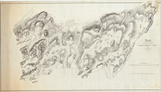

| Title: | Sketch of those Parts of the Hill Grounds of Wester Eskedale and Mains, which are to be planted |
| Imprint: | 1863 |
| Pagination: | 1 map: col.; 72 x 130 cm. |
| Shelfmark: | Lovat179 |
| Notes: | Map showing proposed plantation on the hill ground to S & W of Eskadale Mains and Chapel Scale 1:3960. (40 chains = 8" ). Courtesy of Lovat Highland Estates and the North of Scotland Archaeological Society. View Lovat Highland Estates mapping |
| Zoom Into Map: | Click on the map to view in greater detail. |