Estate Maps, 1750s-1900s
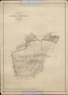

| Title: | Plan of the Crerag Crofts etc part of Eskedale, 1857. |
| Imprint: | 1857 |
| Pagination: | 1 manuscript map: col.; 70 x 51 cm. |
| Shelfmark: | Lovat162 |
| Notes: | Sets out croft boundaries and areas Scale 1:2400. (20 chains = 6.6" ). Courtesy of Lovat Highland Estates and the North of Scotland Archaeological Society. View Lovat Highland Estates mapping |
| Zoom Into Map: | Click on the map to view in greater detail. |