Estate Maps, 1750s-1900s
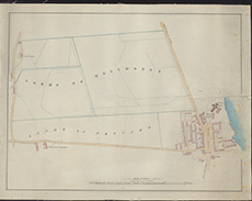

| Title: | [Beauly and part of Wellhouse] |
| Imprint: | 1830s ? |
| Pagination: | 1 manuscript map: col.; 39 x 50 cm. |
| Shelfmark: | Lovat121 |
| Notes: | Looks like early 19th century map, showing Beauly with lands of Croyard and Wellhouse Scale 1:2437. (20 chains = 6.5" ). Courtesy of Lovat Highland Estates and the North of Scotland Archaeological Society. View Lovat Highland Estates mapping |
| Zoom Into Map: | Click on the map to view in greater detail. |