Estate Maps, 1750s-1900s

| Name: | Gordon, David, 1820-1893 |
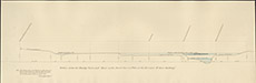
| Title: | Section from Beauly Pier along the Parliamentary Road etc on the plan of Groam to the point opposite Beaufort Castle. |
| Imprint: | 1858 |
| Pagination: | 1 map: col.; 72 x 128 cm. |
| Shelfmark: | Lovat117-2 |
| Notes: | Sections showing the topography along the Beauly River. Scale 1:240. (100' = 5" ). Courtesy of Lovat Highland Estates and the North of Scotland Archaeological Society. View Lovat Highland Estates mapping |
| Zoom Into Map: | Click on the map to view in greater detail. |