Estate Maps, 1750s-1900s

| Name: | Gordon, David, 1820-1893 |
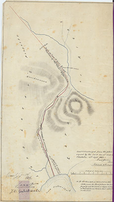
| Title: | Sletch copied from the plan signed by the Lord Lovat and the Chisholm 15th Sept 1842. |
| Imprint: | 1881 |
| Pagination: | 1 manuscript map: col.; 58 x 32 cm. |
| Shelfmark: | Lovat100 |
| Notes: | An 1881 sketch of the 1838 map used in an 1842 disposition, concerning the march between Lovat & Chisholm. Scale 1:1584. (10 chains = 5" ). Courtesy of Lovat Highland Estates and the North of Scotland Archaeological Society. View Lovat Highland Estates mapping |
| Zoom Into Map: | Click on the map to view in greater detail. |