Estate Maps, 1750s-1900s

| Name: | Ordnance Survey |
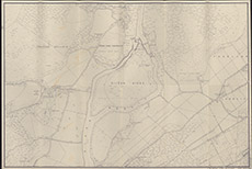
| Title: | Crask of Aigas. |
| Imprint: | 1950s ? |
| Pagination: | 1 map; 67 x 99 cm. |
| Shelfmark: | Lovat096 |
| Notes: | Seems to be special 25" OS map, centred on Eilean Aigas (not the Crask), drawn in the late 1950's Scale 1:2534. (25" = 1 mile ). Courtesy of Lovat Highland Estates and the North of Scotland Archaeological Society. View Lovat Highland Estates mapping |
| Zoom Into Map: | Click on the map to view in greater detail. |