Estate Maps, 1750s-1900s
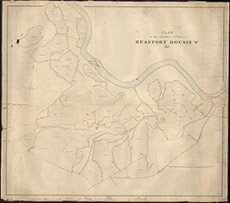

| Title: | Plan of the Arable Lands of Beaufort Dounie, 1857 |
| Imprint: | 1857 |
| Pagination: | 1 manuscript map: col.; 94 x 107 cm. |
| Shelfmark: | Lovat086 |
| Notes: | Describes the farms and landholdings in Kiltarlity Scale 1:3168. (20 chains = 5" ). Courtesy of Lovat Highland Estates and the North of Scotland Archaeological Society. View Lovat Highland Estates mapping |
| Zoom Into Map: | Click on the map to view in greater detail. |