Estate Maps, 1750s-1900s
| Name: | Edward Sang & Sons, Kirkcaldy |
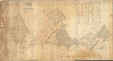
| Title: | Plan of the Lands of Redcastle, the Property of Patrick Grant, Esquire |
| Imprint: | 1824 |
| Pagination: | 1 manuscript map: col.; 118 x 219 cm. |
| Shelfmark: | Garguston |
| Notes: | (50 chains = 25 cm ). Courtesy of the North of Scotland Archaeological Society. View Lovat Highland Estates mapping. |
| Zoom Into Map: | Click on the map to view in greater detail. |