Estate Maps, 1750s-1900s

| Name: | Brown, John, fl. 1803-1832 |
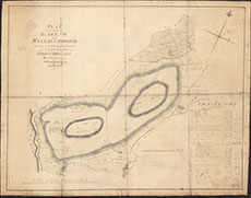
| Title: | Plan of the Lands of Barend and Killie Crookie |
| Imprint: | March 20, 1805 |
| Pagination: | 1 manuscript map; 66 x 85 cm. |
| Shelfmark: | #7387 |
| Notes: | Courtesy of Kirkcudbright Museum through the Dumfries Archival Mapping Project - view futher details. |
| Zoom Into Map: | Click on the map to view in greater detail. |