Estate Maps, 1750s-1900s

| Name: | Howatson, John |
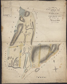
| Title: | Plan of the Farm of Jordiland belonging to the Right Hon, The Earl of Selkirk |
| Imprint: | [c.1800] |
| Pagination: | 1 manuscript map : col.; 51 x 41 cm. |
| Shelfmark: | 2005/22/05 |
| Notes: | Courtesy of Kirkcudbright Museum through the Dumfries Archival Mapping Project - view futher details. |
| Zoom Into Map: | Click on the map to view in greater detail. |