John Home's Survey of Assynt in 1774
Introduction
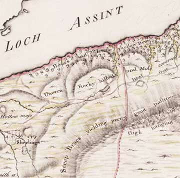
John Home's Survey of Assynt was the earliest detailed comprehensive mapping of Assynt. For the Sutherland estate owners, it was the most expensive survey of the 18th century, resulting in a beautifully executed volume of 16 plans of farms, with detailed accompanying descriptions. The descriptions contain a wide variety of information, such as agricultural practices and potential, the main resources of the region, accurate measurements of land under crops or used for the pasturing of livestock, and attractive and useful vignettes of the inhabitants, their clothes, houses, and lives. The context to the volume in terms of estate mapping, and the history of Assynt, are briefly reviewed below.
Information about the Survey of Assynt is organised in the following sections below:
Estate surveys
Compared to England, the land-surveying profession developed late in Scotland, growing from the 1720s to reach peaks in the 1770s and 1810s, before a sharp decline by the 1850s. Land surveying played a crucial role in the reorganisation of the landscape at this time, introducing new agricultural methods, reclaiming marsh and moorland, dividing commonty or common land amongst private owners, straightening roads, building bridges, planning new villages and promoting new rural manufacturing. In what was often previously an open and fairly incoherent agricultural scene, half moorland with a few trees, land-surveyors were responsible for creating the more ordered, geometrical, fenced and wooded landscape that we are familiar with today.
Land-surveying often had close links with the teaching of mathematics and geometry. Essentially, it was a practical implementation of a range of measuring skills, often allied to judging the potential of the land and the calculation of rents. Contacts between landowners and surveyors were important in spreading ideas and techniques, and we know that John Home had contacts with several other surveyors in the north-east of Scotland from the 1760s, including James Robertson, Alexander and George Taylor, and Thomas Milne. After the 1745 Jacobite uprising, several landlords that had been Jacobite supporters had their lands forfeited, and managed by the Commissioners for the Annexed Forfeited Estates. This body became a powerhouse of ideas in promoting accurate surveys and agricultural improvement. Over about a century, Scottish land surveyors drafted more than 50,000 detailed plans, many of which survive today, particularly in the National Archives of Scotland.
![]()
Introduction and estate surveys | Assynt - history and context | John Home (1733/4-1809) and his survey