County maps, 1580s-1950s
| Field | Content |
|---|---|
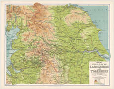
| Title: | Philips' regional wall map of Lancashire and Yorkshire. Scale 1:200,000, etc. |
| Imprint: | London, [1940] |
| Pagination: | 1 map ; 851 x 1017 mm. |
| Shelfmark: | Map.l.3.73 |
| Notes: | Scale 1:200,000 |
| Zoom Into Map: | Click on the map to view in greater detail. |