County maps, 1580s-1950s
| Field | Content |
|---|---|
| Name: | Ordnance Survey |
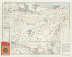
| Title: | Ordnance Survey, 1:25,000. The Antonine Wall |
| Imprint: | Southampton : Ordnance Survey, 1969 |
| Pagination: | 1 map col. ; 78 x 101 cm. |
| Shelfmark: | Map.Area.C18:11(04) |
| Zoom Into Map: | Click on the map to view in greater detail. |