Admiralty Charts of Scotland, 1795-1904
| Field | Content |
|---|---|
| Name: | Great Britain. Hydrographic Office |
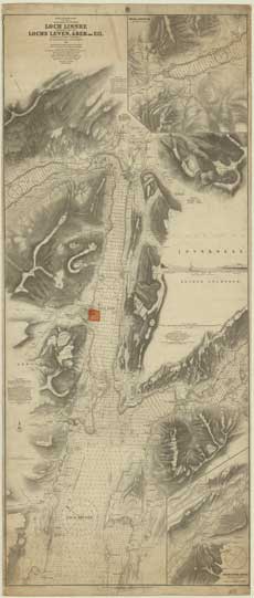
| Title: | Scotland - West Coast - Loch Linnhe, Northern Part and Lochs Leven, Aber and Eil |
| Imprint: | [London: Hydrographic Office], revised to Feb 1912 |
| Pagination: | 1 map; 68 x 162 cm. |
| Shelfmark: | Admiralty Chart 1426 |
| Notes: | View georeferenced chart |
| Zoom Into Map: | Click on the map to view in greater detail. |