Pont maps | Pont texts | biographies | history | subjects | further reading
Pont Maps of Scotland, ca. 1583-1614 - Pont texts
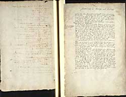
Statheirin in Murrey and Lochmuy
Pagination: 154v-155r
Notes:
Several of these placenames and this area are shown on Pont 8.
Transcription of text:
Statheirin in Murrey and Lochmuy
Kirk of Muy from Inveresse 8 myle south situate on the west syde of Loch Muy. Loch muy is tuo myle in lenth and on in breadth somewhat ovale shapen, it lyes SE and NW. Illen na Muye is in the midst of the Loch, but neerest the west, a Bow shotte in lenth its shape is thus and in it is Mackintoish his house scituate called after the name of the isle. [Dowrie fl]
In this Loch are fownde trowts called Reedwyms takne only betuxt Mickalmess and Hallowmesse
At the North end of the Loch standes Muymoir, at the west a woode [Cloichscoilk or the cloven stone] equall in lenth with the Loch, at the south end of both lyes Tulloch Cleure. West of the Loch stands Muy begg and the kirke Alt na slanach from the Loch NW and W 1/2 myle ane wood called Kyle na hiren just west from it ane other called Craig na en or the Birds woode, hear is a burne tuixt the townes and the woode 2 myle in lenth and a burne at every towne running into the loch. Item a third wood called Derirr na cloich or the scrabblachwood. Item another wood 1/2 myle above Muy beg W called Derirr na Shamprak or the Cleverwoode ane other woode due S. from Muy beg called Liadeirr or Letir the lyart woode and a Bush beneath it neer the south nooke of the Loch called Letyir beg.
The other woode which extendes the lenth of the loch is called Letyr Moir.
The water of Fintack runnes out of the Loch SE and upon it is a Milne, it runnes into Findorne fourteen myles above Tarnowaye. Tulloch mak garre is W of Fintacke. Slyach is E. of Fintack lying besyde the milne. The townes over against other midwaye tuixt the loch and water
At the inver of the water NE of Findorne lyes Ruven on the syde of Findorne water. on that same syde lyes Keancraig a myle beneath Ruven with a great Craige named Craigcrokan or the Steepie craige. 1/2 myle under it on the same syde lyes Lagriach or the spotted valley. The nethermost towne of that part called Bothagan not 1/4 myle distant from the other towne
On the S. syde of the water of Findorne which runnes from SW to NE standes Cochlachin 4 myles from Muy begg. above that 1/4 m. standes Baalcrohan and from that 1 m. standes Pollochack or the Loch poole. a wood interjected twixt the forsaid townes called Dow lettyir. then a wood above called Lettyirgaleirie. Corry bruoch beg or the little bray quarrell a towne standing a myle SW from the last named towne and Letyir galeirie interjected betuixt the two, ane other called Corry bruoch moir 1/2 myle from the other it lyes due south from Findorne.


![Previous: Sent out the south to me in Febr. 1646, [Distances in Cuningham Kyl Carrict Ranfrow]](../../img/previous.gif)

