Pont maps | Pont texts | biographies | history | subjects | further reading
Pont Maps of Scotland, ca. 1583-1614 - Pont texts
Noats of Distances of Places about head of Loch Tay, Loch Erin, L. Dochart, Glen-wrquhay &c
Click on image to zoom into text


![Next:Ross and the parts thereof out [of] Mr Tim. Pont his paperis.
Loch Kiserin, Loch Turretan](../../img/next.gif)

Scroll through text pages
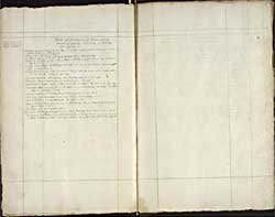
Pagination: 117v-118r
Transcription of text:
Noats of Distances of Places about head of Loch Tay, Loch Erin, L. Dochart, Glen-wrquhay &c
[Thir I had from Glenwrquhay himself in June 1644 at Abirdeen]
Distance betuix L. Erin and L. L.Tay - 9 myles. others recon it but 7 myl at the farrest betuixt the heads of them.
Loch Erin - 5 myl of lenth.
Loch Tay 10 myl the neerest way betuix Ballach and the kirk of Killyn.
Kyllyn L. Dochar 9 myl and the kirk of Strafillen 3 myl above the Loch, the loch itself is of lenth -
Castell Cheul-Cheurn and Finlarig - 26 myl, the way is up Dochart river to the kirk of Stra-fillen etc.
Wrchay river is 12 myl long, it ends at end of Loch aw, at the nordeast part therof it cums from L. Tully - 3 myl long.
Clachan Disert in Glenwrquhay and Loch Rennach - 24 myl.
Innerara and the neerest part of Loch aw to it - 8 myl.
Skibbenes in Cantyr, whair L. Fyn is cownted to begin, and head of L Fyn - 40 m.
Crowachan Bain the hiest hill in all Lorne or the neighboring cowntreys and Bin nevish in Lochabyr - 24 m.
Head of Loch Fyn is distant from the neerest part of L. Aw 8 m.
Loch Gher besyd Rosneth, is of lenth above the narrow ferry 3 m.
Neerest distance betuix Arren yle and Argyl - 12
Kirk of Clachan-Disert upon Loch aw in Glenwrquhy and the kirk of Kilmourich upon L. Fyn - 8 m.
Innerara and Kilmourich - 6 m.
Innerara and During ferry upon L. Aw - 8 m.
During and the end of L. Aw 14. m.
St Jhonstoun and Ballach at the foot of Loch Tay ar distant 26 m if yow go be Dunkeld and follow the river, but be the neerest way throw Glen Almond, it is only 18. Continued