Maps of Scotland
| Field | Content |
|---|---|
| Name: | Reynolds, W. H. |
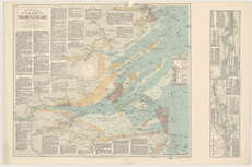
| Title: | Reynold's new chart of the Thames Estuary. |
| Imprint: | London : E. Stanford Ltd., 1921. |
| Pagination: | 1 map ; 522 x 602 mm. |
| Shelfmark: | Map.l.30.59 |
| Notes: | Scale 1:145,920 Inset: The River Thames from London to Gravesend. |
| Zoom Into Map: | Click on the map to view in greater detail. |