Military Maps of Scotland (18th century)
| Field | Content |
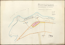
|---|---|
| Title: | Plan shewing in red the ground required for the construction of a battery at Whiteforeland Point [in Greenock], etc. |
| Description: | 1 map ; 385 x 561 mm |
| Date on Map: | ca. 1860 |
| Placename: | Greenock |
| Parish: | Greenock |
| County: | Renfrewshire |
| Shelfmark: | EMS.s.444B |
| Zoom Into Map: | Click on the map to view in greater detail. |
All images © National Library of Scotland