Military Maps of Scotland (18th century)
| Field | Content |
|---|---|
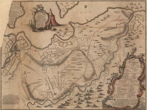
| Title: | A plan of the battle of Culloden and the adjacent country, shewing the Incampment of the English Army at Nairn and the March of the Highlanders in order to attack them by night |
| Name: | Finlayson, John ? |
| Description: | 1 map : col. ; 564 x 748 mm. |
| Original Survey: | 1746? |
| Date on Map: | 1746? |
| Placename: | Culloden |
| Parish: | Inverness, Croy, Daviot and Dunlichity |
| County: | Inverness-shire |
| Shelfmark: | EMS.s.156 |
| Zoom Into Map: | Click on the map to view in greater detail. |