Military Maps of Scotland (18th century)
| Field | Content |
|---|---|
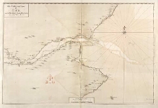
| Title: | The Frith and River of Tay with all the Rocks, Sands, Shoals, &c..[manuscript copy] |
| Name: | Adair, John |
| Description: | 1 manuscript map ; 418 x 630 mm., on sheet, 521 x 730 mm. |
| Original Survey: | 1703 |
| Date on Map: | 1703 |
| Shelfmark: | MS.1651 Z.69/01 |
| Zoom Into Map: | Click on the map to view in greater detail. |
All images © Crown Copyright and © National Library of Scotland