Military Maps of Scotland (18th century)
| Field | Content |
|---|---|
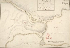
| Title: | A Plan of ye Barrack at Kiliwhiman and of the Ground within the Bounds of it betwixt the Two Rivers; and the Letters A.B.C [copy] |
| Name: | Dumaresq, John & Bastide, John Henri (Engineer) Bastide, John Henri (Draughtsman) |
| Description: | 1 manuscript map ; 313 x 449 mm., on sheet, 322 x 461 mm. |
| Original Survey: | 1719 |
| Date on Map: | 1719 |
| Placename: | Fort Augustus |
| Parish: | Boleskine and Abertarff |
| County: | Inverness-shire |
| Shelfmark: | MS.1647 Z.03/08b |
| Zoom Into Map: | Click on the map to view in greater detail. |