Military Maps of Scotland (18th century)
| Name: | [Dury, Theodore] |
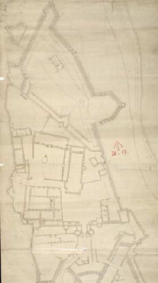
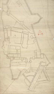
| Title: | [Stirling Castle, showing plans to fortify the main entrance and the nether bailey] |
| Original Survey: | [1708?] |
| Date on Map: | [1708?] |
| Description: | 1 manuscript map ; 897 x 432 mm., on sheet, 897 x 462 mm |
| Placename: | Stirling |
| County: | Stirlingshire |
| Shelfmark: | MS.1646 Z.02/16b |
| Zoom Into Map: | Click on the maps below to order image or view in greater detail. |
All images © Crown Copyright and © National Library of Scotland
Copyright Enquiries & Copies Help