Military Maps of Scotland (18th century)
| Field | Content |
|---|---|
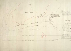
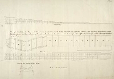
| Title: | Fort George; Plan of the pier |
| Original Survey: | [post-1756] |
| Description: | 1 manuscript map ; 398 x 1012 mm |
| Placename: | Fort George (Inverness) |
| Parish: | Inverness and Bona |
| County: | Inverness-shire |
| Shelfmark: | MS.1647 Z.02/58 |
| Zoom Into Map: | Click on the maps below to order image or view in greater detail. |
 |
 |