Military Maps of Scotland (18th century)
| Field | Content |
|---|---|
| Name: | Skinner, William Tarrant, Charles |
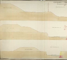
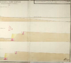
| Title: | Sections of Fort George Shewing how far the works are executed in 1750 |
| Date on Map: | 1750 |
| Description: | 1 manuscript map ; 515 x 1075 mm., on sheet, 538 x 1084 mm |
| Placename: | Fort George (Ardersier) |
| Parish: | Ardersier |
| County: | Inverness-shire |
| Shelfmark: | MS.1646 Z.02/41a |
| Zoom Into Map: | Click on the maps below to order image or view in greater detail. |
 |
 |