Mapmakers
Your search for Mason, J returned 7 records.
Ordered chronologically (undated items first).

| Field | Content | |
|---|---|---|
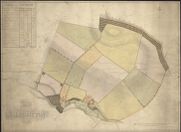
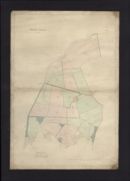
| Name: | Mason, John. | |
| Title: | Plan of the regality of Canongate ... / surveyed and engraved under the superintendency of ... John Mason ... by William Bell. Plan of North Leith within the Regality of Canongate. | |
| Imprint: | [Edinburgh], 1813. | |
| Zoom Into Map: | Click on the map to view in greater detail. | |
| Field | Content | |
|---|---|---|
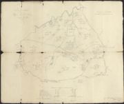
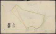
| Name: | Mason, John, jnr | |
| Title: | Plan of Gilchriston, measured in 1824. | |
| Imprint: | 1824 | |
| Zoom Into Map: | Click on the map to view in greater detail. | |
| Field | Content | |
|---|---|---|
| Name: | Mason, John, jun. | |
| Title: | Rough Sketch of Upper Keith Farm surveyed Feb. 1829. | |
| Imprint: | 1829 | |
| Zoom Into Map: | Click on the map to view in greater detail. | |
| Field | Content | |
|---|---|---|
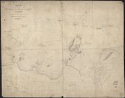
| Name: | Mason, John | |
| Title: | Dunbar - Castle and Bay, showing proposed breakwater, pier and harbour | |
| Imprint: | 1837 | |
| Zoom Into Map: | Click on the map to view in greater detail. | |
| Field | Content | |
|---|---|---|
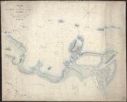
| Name: | Mason, John | |
| Title: | Dunbar - Castle and Bay, showing proposed breakwater, pier and harbour | |
| Imprint: | 1837 | |
| Zoom Into Map: | Click on the map to view in greater detail. | |
| Field | Content | |
|---|---|---|
| Name: | Mason, John | |
| Title: | West Barns - Plan of distillery and Park | |
| Imprint: | 1838 | |
| Zoom Into Map: | Click on the map to view in greater detail. | |
| Field | Content | |
|---|---|---|
| Name: | Mason, John | |
| Title: | West Hall Farm | |
| Imprint: | 1862 | |
| Zoom Into Map: | Click on the map to view in greater detail. | |