Mapmakers
Your search for Laurie returned 32 records.
Ordered chronologically (undated items first).
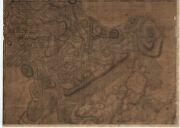
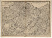
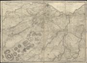
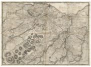
| Name: | Laurie, John, fl. 1757-1800 | |
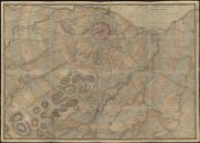
| Title: | A plan of the county of Mid-Lothian… | |
| Subtitle: | North-west sheet | |
| Imprint: | [Edinburgh?] : s.n., 1763. | |
| Zoom Into Map: | Click on the map to view in greater detail. | |
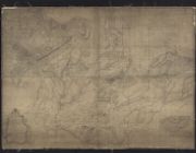
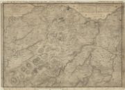
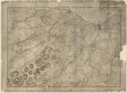
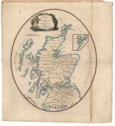
| Name: | Laurie, John, fl. 1757-1802 | |
| Title: | A plan of the county of Mid-Lothian or Shire of Edinburgh ... / from an actual survey made & drawn by John Laurie, 1763. (Alexr. Baillie sculpsit.). | |
| Imprint: | [S.l.], 1763. | |
| Zoom Into Map: | Click on the map to view in greater detail. | |
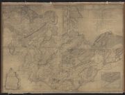
| Name: | Laurie, John, fl. 1757-1803 | |
| Title: | A plan of the county of Mid-Lothian or Shire of Edinburgh ... / from an actual survey made & drawn by John Laurie, 1763. (Alexr. Baillie sculpsit.). | |
| Imprint: | [S.l.], 1763. | |
| Zoom Into Map: | Click on the map to view in greater detail. | |
| Name: | Laurie, John, fl. 1757-1804 | |
| Title: | A plan of the county of Mid-Lothian or Shire of Edinburgh ... / from an actual survey made & drawn by John Laurie, 1763. (Alexr. Baillie sculpsit.). | |
| Imprint: | [S.l.], 1763. | |
| Zoom Into Map: | Click on the map to view in greater detail. | |
| Name: | Laurie, John, fl. 1757-1800 | |
| Title: | A plan of Edinburgh and places adjacent. | |
| Imprint: | [Edinburgh : s.n., 1766] | |
| Zoom Into Map: | Click on the map to view in greater detail. | |
| Name: | Laurie, John, fl. 1757-1800 | |
| Title: | Plan of Edinburgh and places adjacent from an actual survey / by John Laurie. Plan d'Edinbourg et de ses environs levee sur les lieux par Jean Laurie. Alexr. Baillie sculpsit, 1766. | |
| Imprint: | [Edinburgh] : s.n., [1766] | |
| Zoom Into Map: | Click on the map to view in greater detail. | |
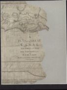
| Name: | Whitworth, Robert, 1734-1799 Laurie, John, fl. 1757-1800 Ainslie, John, 1745-1828 | |
| Title: | A plan of the Great Canal from Forth to Clyde / by Robt. Whitworth... and... John Laurie. Drawn and engraved by John A inslie... | |
| Imprint: | [Glasgow], 1785. | |
| Zoom Into Map: | Click on the map to view in greater detail. | |
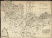
| Name: | Laurie, John, fl. 1757-1801 | |
| Title: | A plan of Edinburgh and the country adjacent ... / delineated by John Laurie. | |
| Imprint: | Edinburgh : W Creech, 1786. | |
| Zoom Into Map: | Click on the map to view in greater detail. | |
| Name: | Laurie, John, fl. 1757-1800 | |
| Title: | Plan of Edinburgh and the country adjacent ... / delineated by John Laurie. | |
| Imprint: | Edinburgh: W. Creech, 1786 | |
| Zoom Into Map: | Click on the map to view in greater detail. | |
| Name: | Laurie, John, fl. 1757-1800 | |
| Title: | A Plan of Edinburgh and the country adjacent. | |
| Imprint: | Edinburgh : W. Creech, 1786. | |
| Zoom Into Map: | Click on the map to view in greater detail. | |
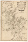
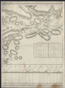
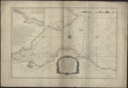
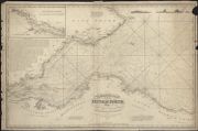
| Name: | Huddart, Joseph, 1740/1-1816 Laurie, Robert Whittle, James | |
| Title: | A new chart of the West coast of Scotland from the Mull of Galloway to Dunan Point in Sky. | |
| Subtitle: | Plate 6 from 'The North-about Navigator', 1818 | |
| Imprint: | London : Laurie & Whittle, 1794 | |
| Zoom Into Map: | Click on the map to view in greater detail. | |
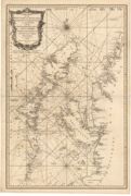
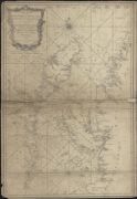
| Name: | Huddart, Joseph, 1740/1-1816 Laurie, Robert Whittle, James | |
| Title: | A new chart of the West coast of Scotland from the point of Ardnamurchan to Cape Wrath. | |
| Subtitle: | Plate 7 from 'The North-about Navigator', 1818 | |
| Imprint: | London : Laurie & Whittle, 1794. | |
| Zoom Into Map: | Click on the map to view in greater detail. | |
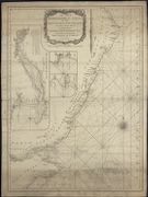
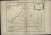
| Name: | Laurie & Whittle | |
| Title: | A new hydrographical survey of the East Coast of Scotland from Buchan Ness to Fife Ness including the Firth of Tay, with the entrance of the Firth of Forth. | |
| Imprint: | London : Laurie & Whittle 1794. | |
| Zoom Into Map: | Click on the map to view in greater detail. | |
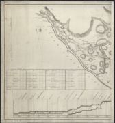
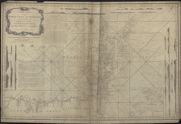
| Name: | Laurie, Richard Holmes. | |
| Title: | A new hydrographical survey of the Firth of Forth, called also South Firth, or Edinburgh Firth …. London, Laurie & Whittle, 1794. | |
| Imprint: | 1794 | |
| Zoom Into Map: | Click on the map to view in greater detail. | |
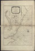
| Name: | Laurie & Whittle | |
| Title: | A new chart of the west coast of Scotland from the Point of Ardnamurchan to Cape Wrath: including the Western Isles of Lewis and Harris, North Uist, Benbecula South Uist, Barra, Sky, Rum etc. & London, Laurie & Whittle, 1794. | |
| Imprint: | 1794 | |
| Zoom Into Map: | Click on the map to view in greater detail. | |
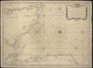
| Name: | Laurie & Whittle | |
| Title: | A new hydrographical survey of the east coast of Scotland, from Pentland Firth to Buchan Ness; including The Firth of Murray, called also the North Firth …. London, Laurie & Whittle, 1794. | |
| Imprint: | 1794 | |
| Zoom Into Map: | Click on the map to view in greater detail. | |
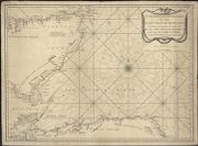
| Name: | Laurie & Whittle | |
| Title: | A new hydrographical survey of the east coast of Scotland, from Buchan Ness to Fife Ness, including the Firth of Tay …… London, Laurie & Whittle, 1794. | |
| Imprint: | 1794 | |
| Zoom Into Map: | Click on the map to view in greater detail. | |
| Name: | Laurie & Whittle | |
| Title: | A new chart of the north coast of Scotland from Cape Wrath to Duncansby Head, with Pentland Firth, and the Orkney Islands, London, 1794. | |
| Imprint: | 1794 | |
| Zoom Into Map: | Click on the map to view in greater detail. | |
| Name: | Whittle, James Laurie, Robert | |
| Title: | A new map of Scotland for ladies needlework. | |
| Imprint: | London : Laurie & Whittle, 1797. | |
| Zoom Into Map: | Click on the map to view in greater detail. | |
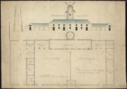
| Name: | Laurie, George ; Waddy, William, Gavintown | |
| Title: | Plan of a Court and Farm Offices [to be built at Swinton Mill (crossed out)] at Delgado (pencil insertion). | |
| Imprint: | 2 April 1803 | |
| Zoom Into Map: | Click on the map to view in greater detail. | |
| Name: | Laurie & Whittle | |
| Title: | Scotland. | |
| Imprint: | London : R Laurie & J Whittle, 1808. | |
| Zoom Into Map: | Click on the map to view in greater detail. | |
| Name: | Laurie, John, fl. 1757-1800 | |
| Title: | A plan of Edinburgh and the country adjacent ... / delineated by John Laurie. | |
| Imprint: | Edinburgh : W Creech, 1811. | |
| Zoom Into Map: | Click on the map to view in greater detail. | |
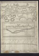
| Name: | Laurie, R.H. | |
| Title: | An hydrographic survey of the Firth of Forth, from St Abb’s Head and Fifeness to Queensferry, with the river thence to Stirling.London, R H Laurie, 1825.Inset:- The River Forth from Stirling to Queensferry. | |
| Imprint: | 1825 | |
| Zoom Into Map: | Click on the map to view in greater detail. | |
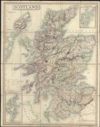
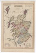
| Name: | Laurie, Richard Holmes. | |
| Title: | Scotland : Ant. Alba, Alban or Albin, Ghaeldoch, Caledonia, Scotia. | |
| Imprint: | London : Richard Holmes Laurie, 1st Feb.1828. | |
| Zoom Into Map: | Click on the map to view in greater detail. | |
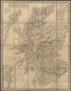
| Name: | Laurie, Richard Holmes. | |
| Title: | Scotland : Ant. Alba, Alban or Albin, Ghaeldoch, Caledonia, Scotia. | |
| Imprint: | London : Richard Holmes Laurie, 5th Jan. 1833. | |
| Zoom Into Map: | Click on the map to view in greater detail. | |
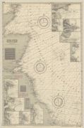
| Name: | Laurie, John (fl. 1757-1800) Whittle, James | |
| Title: | A New Hydrographical Survey of the East Coast of Scotland from Pentland Firth to Buchan Ness. | |
| Date: | 1850 | |
| Zoom Into Map: | Click on the map to view in greater detail. | |
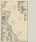
| Name: | Laurie, John (fl. 1757-1800) Whittle, James | |
| Title: | A New Hydrographical Survey of the East Coast of Scotland from Pentland Firth to Buchan Ness. | |
| Imprint: | n.d. | |
| Zoom Into Map: | Click on the map to view in greater detail. | |
| Name: | Imray, Laurie, Norie & Wilson. | |
| Title: | England & Scotland. | |
| Imprint: | St. Ives, Huntingdon : Imray Laurie Norie & Wilson, 1956 | |
| Zoom Into Map: | Click on the map to view in greater detail. | |
| Name: | Imray, Laurie, Norie & Wilson. | |
| Title: | England & Scotland. | |
| Imprint: | St. Ives, Huntingdon : Imray Laurie Norie & Wilson, 1956 | |
| Zoom Into Map: | Click on the map to view in greater detail. | |