Mapmakers
Your search for Lane returned 7 records.
Ordered chronologically (undated items first).
| Field | Content | |
|---|---|---|
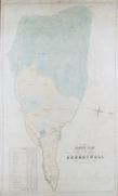
| Name: | W H Macfarlane, Lithographer, Edinburgh | |
| Title: | Sketch Plan of Sundaywell | |
| Zoom Into Map: | Click on the map to view in greater detail. | |
| Field | Content | |
|---|---|---|
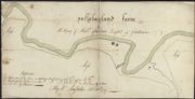
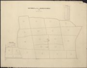
| Name: | MacFarlane, William | |
| Title: | Pullabag-Land Farm | |
| Imprint: | 1779 | |
| Zoom Into Map: | Click on the map to view in greater detail. | |
| Field | Content | |
|---|---|---|
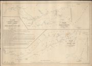
| Name: | Lane, John | |
| Title: | Plans of the Estuaries and Friths of the Rivers or Waters of the Ness, Beauly and Tay from the Admiralty Charts of the Coasts. | |
| Imprint: | 1830, 1845 | |
| Zoom Into Map: | Click on the map to view in greater detail. | |
| Field | Content | |
|---|---|---|
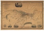
| Name: | Macfarlane, Andrew, fl. 1837-1850 | |
| Title: | Greenock and its environs. | |
| Imprint: | Glasgow : s.n., 1842. | |
| Zoom Into Map: | Click on the map to view in greater detail. | |
| Field | Content | |
|---|---|---|
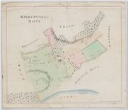
| Name: | Newton & Berry, Chancery Lane | |
| Title: | [Plan of ] Kirkconnell Mains [ Farm and policies, probably based on RHP92626 ] | |
| Imprint: | [Mid 19th century] | |
| Zoom Into Map: | Click on the map to view in greater detail. | |
| Field | Content | |
|---|---|---|
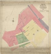
| Name: | Schenck & M'Farlane. | |
| Title: | Skaithmuir and part of Darnchestermuir, 1854 / Schenck & McFarlane, lithrs. | |
| Imprint: | Edinburgh, 1854. | |
| Zoom Into Map: | Click on the map to view in greater detail. | |
| Field | Content | |
|---|---|---|
| Name: | McFarlane & Erskine | |
| Title: | Rough plan of Mr. John Hope's and Heriot's Hospital's grounds at Leith Walk, shewing the Broughton Burn, 1877 ... (Scale ... 1:1056 / McFarlane & Erskine, lithographers). | |
| Imprint: | Edinburgh, 1877 | |
| Zoom Into Map: | Click on the map to view in greater detail. | |