Mapmakers
Your search for Kirk, John returned 18 records.
Ordered chronologically (undated items first).
| Field | Content | |
|---|---|---|
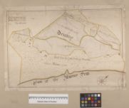
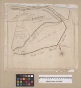
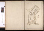
| Name: | Kirk, John (fl. ca. 1760-1773) | |
| Title: | Driemuy | |
| Subtitle: | From: Volume of 13 plans of Golspie and environs, 1767-1829 | |
| Imprint: | Surveyed: ca. 1771-72 | |
| Zoom Into Map: | Click on the map to view in greater detail. | |
| Field | Content | |
|---|---|---|
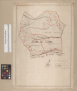
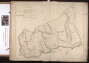
| Name: | Kirk, John (fl. ca. 1760-1773) | |
| Title: | Farm of Rives | |
| Subtitle: | From: Volume of 13 plans of Golspie and environs, 1767-1829 | |
| Imprint: | Surveyed: ca. 1771-72 | |
| Zoom Into Map: | Click on the map to view in greater detail. | |
| Field | Content | |
|---|---|---|
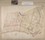
| Name: | Kirk, John (fl. ca. 1760-1773) | |
| Title: | Rives; Golspymore; Golspytower | |
| Subtitle: | From: Volume of 13 plans of Golspie and environs, 1767-1829 | |
| Imprint: | Surveyed: ca. 1771-72 | |
| Zoom Into Map: | Click on the map to view in greater detail. | |
| Field | Content | |
|---|---|---|
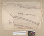
| Name: | Kirk, John (fl. ca. 1760-1773) | |
| Title: | Mellaig Park | |
| Subtitle: | From: Volume of 13 plans of Golspie and environs, 1767-1829 | |
| Imprint: | Surveyed: ca. 1771-72 | |
| Zoom Into Map: | Click on the map to view in greater detail. | |
| Field | Content | |
|---|---|---|
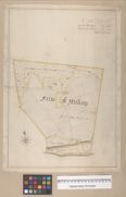
| Name: | Kirk, John (fl. ca. 1760-1773) | |
| Title: | Farm of Mellaig | |
| Subtitle: | From: Volume of 13 plans of Golspie and environs, 1767-1829 | |
| Imprint: | Surveyed: ca. 1771-72 | |
| Zoom Into Map: | Click on the map to view in greater detail. | |
| Field | Content | |
|---|---|---|
| Name: | Kirk, John (fl. ca. 1760-1773) | |
| Title: | Plan of the Mains of Dunrobin | |
| Subtitle: | From: Volume of 13 plans of Golspie and environs, 1767-1829 | |
| Imprint: | Surveyed: ca. 1771-72 | |
| Zoom Into Map: | Click on the map to view in greater detail. | |
| Field | Content | |
|---|---|---|
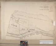
| Name: | Kirk, John (fl. ca. 1760-1773) | |
| Title: | Clayside; Inverboll | |
| Subtitle: | From: Volume of 13 plans of Golspie and environs, 1767-1829 | |
| Imprint: | Surveyed: ca. 1771-72 | |
| Zoom Into Map: | Click on the map to view in greater detail. | |
| Field | Content | |
|---|---|---|
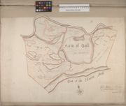
| Name: | Kirk, John (fl. ca. 1760-1773) | |
| Title: | Farm of Doll | |
| Subtitle: | From: Volume of 13 plans of Golspie and environs, 1767-1829 | |
| Imprint: | Surveyed: ca. 1771-72 | |
| Zoom Into Map: | Click on the map to view in greater detail. | |
| Field | Content | |
|---|---|---|
| Name: | Kirk, John (fl. ca. 1760-1773) | |
| Title: | Inverbrora | |
| Subtitle: | From: Volume of 13 plans of Golspie and environs, 1767-1829 | |
| Imprint: | Surveyed: ca. 1771-72 | |
| Zoom Into Map: | Click on the map to view in greater detail. | |
| Field | Content | |
|---|---|---|
| Name: | Kirk, John (fl. ca. 1760-1773) | |
| Title: | Leatich | |
| Subtitle: | From: Volume of 13 plans of Golspie and environs, 1767-1829 | |
| Imprint: | Surveyed: ca. 1771-72 | |
| Zoom Into Map: | Click on the map to view in greater detail. | |
| Field | Content | |
|---|---|---|
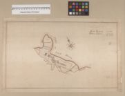
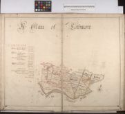
| Name: | Kirk, John (fl. ca. 1760-1773) | |
| Title: | Plan of Part of the Estate of Sutherland the Property of Elizabeth Countess of Sutherland (Coloured plan of Easter Helmsdale and Navidale surveyed and planned by John Kirk, 1771) | |
| Imprint: | 1771 | |
| Zoom Into Map: | Click on the map to view in greater detail. | |
| Field | Content | |
|---|---|---|
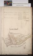
| Name: | Kirk, John (fl. ca. 1760-1773) | |
| Title: | Kintradwell | |
| Subtitle: | From: Book of Plans of the Parish of Loth, The Property of the Countess of Sutherland, containing threeteen different farms / surveyed and planed by John Kirk, 1772 | |
| Imprint: | Surveyed: 1772 | |
| Zoom Into Map: | Click on the map to view in greater detail. | |
| Field | Content | |
|---|---|---|
| Name: | Kirk, John (fl. ca. 1760-1773) | |
| Title: | Lothbeg | |
| Subtitle: | From: Book of Plans of the Parish of Loth, The Property of the Countess of Sutherland, containing threeteen different farms / surveyed and planed by John Kirk, 1772 | |
| Imprint: | Surveyed: 1772 | |
| Zoom Into Map: | Click on the map to view in greater detail. | |
| Field | Content | |
|---|---|---|
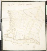
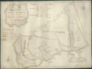
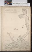
| Name: | Kirk, John (fl. ca. 1760-1773) | |
| Title: | A Plan of Lothmore | |
| Subtitle: | From: Book of Plans of the Parish of Loth, The Property of the Countess of Sutherland, containing threeteen different farms / surveyed and planed by John Kirk, 1772 | |
| Imprint: | Surveyed: 1772 | |
| Zoom Into Map: | Click on the map to view in greater detail. | |
| Field | Content | |
|---|---|---|
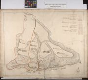
| Name: | Kirk, John (fl. ca. 1760-1773) | |
| Title: | Cuilgower; Wester Garty; Middle Garty | |
| Subtitle: | From: Book of Plans of the Parish of Loth, The Property of the Countess of Sutherland, containing threeteen different farms / surveyed and planed by John Kirk, 1772 | |
| Imprint: | Surveyed: 1772 | |
| Zoom Into Map: | Click on the map to view in greater detail. | |
| Field | Content | |
|---|---|---|
| Name: | Kirk, John (fl. ca. 1760-1773) | |
| Title: | Gartymore | |
| Subtitle: | From: Book of Plans of the Parish of Loth, The Property of the Countess of Sutherland, containing threeteen different farms / surveyed and planed by John Kirk, 1772 | |
| Imprint: | Surveyed: 1772 | |
| Zoom Into Map: | Click on the map to view in greater detail. | |
| Field | Content | |
|---|---|---|
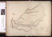
| Name: | Kirk, John (fl. ca. 1760-1773) | |
| Title: | Wester Helmsdale | |
| Subtitle: | From: Book of Plans of the Parish of Loth, The Property of the Countess of Sutherland, containing threeteen different farms / surveyed and planed by John Kirk, 1772 | |
| Imprint: | Surveyed: 1772 | |
| Zoom Into Map: | Click on the map to view in greater detail. | |
| Field | Content | |
|---|---|---|
| Name: | Kirk, John (fl. ca. 1760-1773) | |
| Title: | Navidale; E Helmsdale | |
| Subtitle: | From: Book of Plans of the Parish of Loth, The Property of the Countess of Sutherland, containing threeteen different farms / surveyed and planed by John Kirk, 1772 | |
| Imprint: | Surveyed: 1772 | |
| Zoom Into Map: | Click on the map to view in greater detail. | |