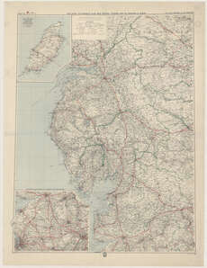
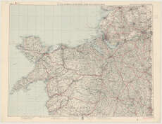
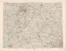
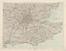
Maps of England and Wales
| Field | Content |
|---|---|
| Name: | Royal Automobile Club (Great Britain) |
| Title: | The Royal Automobile Club new official touring map of England & Wales. |
| Imprint: | [London : G. Philip & Son, 1937] |
| Pagination: | 10 sheets ; 718 x 980 mm. |
| Shelfmark: | Map.l.15.4 |
| Notes: | Scale 1:200,000 Sheets 1, 3, 7, 10 only. |
| Zoom Into Map: | Click on the maps below to order image or view in greater detail. |