Edinburgh Boundaries viewer - Help
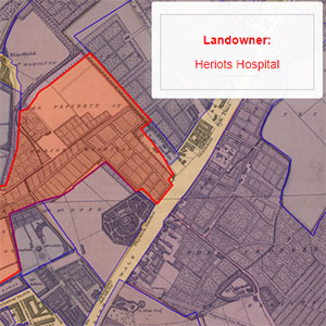
This viewer shows a selection of traced boundaries relating to Edinburgh, including the boundaries of landownership (1804-1817), Police Wards (1822-1848), Sanitary Districts (1864-1880), Municipal Wards (1852-1902), and Registration Districts (1865-1902).
We have also traced the extensions of the Royalty Boundary from 1685 to 1885, and Bartholomew's Chronological Map of Edinburgh (1919).
Zoom in on any location, hover or tap on the map, and details of the specific area feature covering the place are shown in a Results panel to the right.
View other boundaries by selecting them in the drop-down list in the left-hand panel.
These boundaries were traced by the Visualising Urban Geographies project, 2009-11. You can read more about Visualising Urban Geographies in the following paper: R. Rodger, C. Fleet, S. Nicol, Visualising Urban Geographies, ePerimetron 5(3), 2010.
The boundaries can all be downloaded for onward re-use.

Background map
By default, the background map shows an historic georeferenced map of Edinburgh overlaid on a modern Stamen Toner layer. Select the drop-down list in the top-centre of the map to choose other historic map layers, Bing road layer, Bing satellite or hybrid layers, OpenStreetMap, or Ordnance Survey Opendata as background maps.
Rotation
Hold the [Alt] and [Shift] keys, and drag with your cursor (ie. hold the left-hand mouse button down and drag) to rotate. Refresh the page or double-click the rotation arrow (top right) to return to the default rotation.
Location
In the lower-right of the map, the location of your mouse position is shown as a British National Grid Reference, as British National Grid Eastings and Northings, and as longitude and latitude.
Linking to the viewer
The URL in your web browser address bar changes dynamically as you zoom and pan the map, and when you alter visible map layers and overlays. You may copy or bookmark the URL in your web browser address bar to save the current viewer location and zoom level.
Application
This application uses OpenLayers
Please email maps@nls.uk for further assistance, or to provide general comments/feedback.