Maps of England and Wales
| Field | Content |
|---|---|
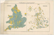
| Title: | Political map of England and Wales as represented in Parliament March 1879. |
| Imprint: | London : E. Stanford, 1879. |
| Pagination: | 1 map ; 318 x 518 mm. |
| Shelfmark: | Map.l.24.25 |
| Zoom Into Map: | Click on the map to view in greater detail. |