Maps of Great Britain and Ireland
| Field | Content |
|---|---|
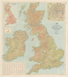
| Title: | Bartholomew's Contour motoring map of the British Isles ... |
| Imprint: | [Edinburgh, 1935] |
| Pagination: | 1 map ; 977 x 845 mm. |
| Shelfmark: | Map.l.4.11 |
| Notes: | Scale 1:1,000,000 Insets: London [and] Ministry of transport numbering of main roads. |
| Zoom Into Map: | Click on the map to view in greater detail. |