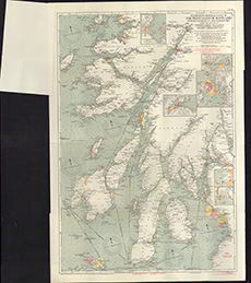
Coastal and marine charts, 1580-1850
| Field | Content |
|---|---|
| Name: | Stanford's Geographical Establishment |
| Title: | Stanford's general chart of the West Coast of Scotland from Mull of Kintyre to Ardnamurchan Point, together with inset charts ... / prepared under the supervision of ... O.M. Watts, etc. |
| Pagination: | 1 map ; 930 x 629 mm. |
| Shelfmark: | Map.m.2.7 |
| Zoom Into Map: | Click on the map to view in greater detail. |

