Coastal and marine charts, 1580-1850
| Field | Content |
|---|---|
| Name: | Adair, John, ca. 1650-1722 |
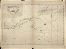
| Title: | The Frith and River of Tay with all the Rocks, Sands, Shoals, &c. |
| Imprint: | [ca. 1703] |
| Pagination: | 1 map; 52 x 69 cm |
| Shelfmark: | Stevenson Parcel 2, 13 |
| Zoom Into Map: | Click on the map to view in greater detail. |

