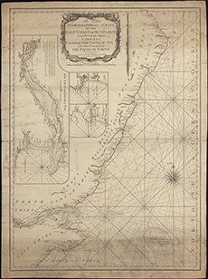
Coastal and marine charts, 1580-1850
| Field | Content |
|---|---|
| Name: | Laurie & Whittle |
| Title: | A new hydrographical survey of the East Coast of Scotland from Buchan Ness to Fife Ness including the Firth of Tay, with the entrance of the Firth of Forth. |
| Imprint: | London : Laurie & Whittle 1794. |
| Pagination: | 1 map ; 687 x 493 mm. |
| Shelfmark: | Signet.s.132 |
| Notes: | We are very grateful to the WS Society for their permission to display this map online. View Signet Library collection maps of Scotland held at NLS. |
| Zoom Into Map: | Click on the map to view in greater detail. |

