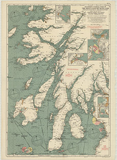
Coastal and marine charts, 1580-1850
| Field | Content |
|---|---|
| Name: | Stanford's Geographical Estabt. |
| Title: | Stanford's general chart of the West Coast of Scotland from Mull of Kintyre to Ardnamurchan Point together with inset charts of Tobermory Harbour, Oban Harbour, East Loch Tarbert, Loch Crinan, Loch Gilp, Campbeltown Loch / prepared under the supervision |
| Imprint: | London, 1938 |
| Pagination: | 1 map ; 932 x 632 mm. |
| Shelfmark: | Map.m.28.1 |
| Zoom Into Map: | Click on the map to view in greater detail. |

