Admiralty Charts of Scotland, 1795-1904
| Field | Content |
|---|---|
| Name: | Great Britain. Hydrographic Office Robinson, Captain |
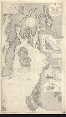
| Title: | Firth of Clyde and Loch Fyne |
| Imprint: | [London: Hydrographic Office], 1846-9. Revised to 1932 |
| Pagination: | 1 map; 715 x 1235 mm. |
| Shelfmark: | MS.5846, No.45 |
| Notes: | Admiralty Chart 2131. This map is from our Stevenson civil engineering plans collection. |
| Zoom Into Map: | Click on the map to view in greater detail. |