Ordnance Survey Maps - 25 inch 2nd and later editions, Scotland, 1892-1949
Introduction
The Ordnance Survey 25 inch to the mile (or 1:2,500) County Series forms the most detailed topographic mapping for all the inhabited regions of Scotland from the 1890s to the 1940s. The series is made up of 17,466 map sheets, and all were revised from 1892-1907. Sheets covering more populated and rapidly changing areas were selectively revised from 1914 to the 1940s.
The maps are immensely valuable for local history, allowing practically every feature in the landscape to be shown. They provide good detail of all buildings, streets, railways, industrial premises, parkland, farms, woodland, and rivers. Their bold and clear style allows easy interpretation for a wide range of uses.
This website allows all out-of-copyright OS 25 inch to the mile County Series maps of Scotland to be viewed.
In this section
- Characteristics, content, acreages and geographic coverage
- Projections, meridians, revision, and sheet numbering
Principal characteristics

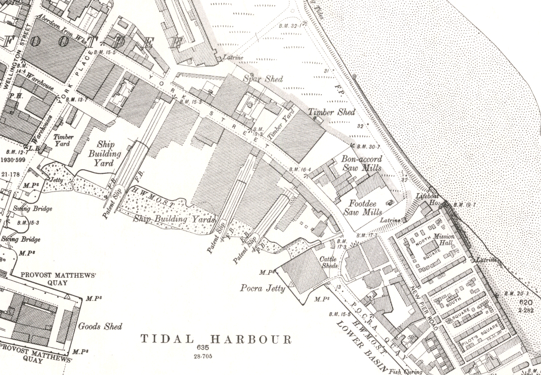
of Aberdeen harbour, 1899
The Ordnance Survey 25 inch maps are a standard topographic authority, depicting practically all human and natural features in the landscape with great accuracy. As for the six inch maps, every road, railway, field, fence, wall, stream and building is shown. There are over 10 different symbols for types of woodland, and uncultivated ground is distinguished into marsh, bog and rough grassland. All public boundaries and administrative boundaries (including civil parish, municipal ward, burgh, and county boundaries) are clearly shown. The extensive revisions to boundaries through the Local Government Acts of 1889-1894 can be clearly seen by comparison with the boundaries shown on the first edition 25 inch maps. Spot heights in feet above mean sea level at Liverpool (and then Newlyn from 1921) are shown along roads, railways, etc.
Detailed map content
The 25 inch maps are four times larger than the six inch, so that all landscape features can be shown in plan form without generalisation. The 25 inch maps are more useful for the history of:
- Land valuation / registration purposes and conveyancing - old title deeds often refer to specific numbered land parcels on these maps
- Railway developments - railway tracks and stations are shown in plan form, with many smaller features, such as signal boxes
- Agricultural development - changes in land use and farm buildings, as well as quarries and lime kilns
- Urban change - greater detail for all buildings, including divisions between contiguous houses, and industrial premises
- Water supply and sewerage, mill lades, as well as docks, harbours and quaysides
- All public boundaries, including civil parishes, municipal wards, as well as burgh and county boundaries.

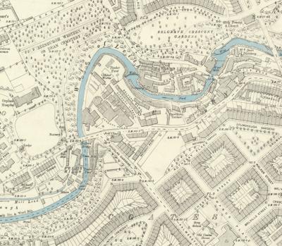
Edinburgh, 1893.
Over time, changes in Ordnance Survey policy and the need to make economies also changed the detailed content on the maps. For example:
- field names were omitted after 1888
- the recording of bay windows, garden paths, gates (except across roads), and hedgerow timber was discontinued after 1892
- the Royal Scottish Geographical Society's Place Names Committee was formed in 1893, and recommended revised place names on the maps from this time
- public buildings were distinguished from 1897
- the new Ordnance Survey Archaeological Officer, appointed in 1920, led to improved recording of antiquities on Ordnance Survey maps from this time
- new Ministry of Transport road numbers appear from the 1940s
Security deletions
As with other scales of Ordnance Survey maps, various features that were classified or deemed to be 'secret', were omitted from these maps. The definition of these has varied over time and may include features such as airfields, armament depots, explosive works, gas and electricity works, nuclear research or armament premises, oil depots, and prisons.
- Read further information about security deletions based on the OS 'blue-and-black' drawings
Acreages and Land Parcels
The 25 inch maps record acreages of all land parcels on the map below each parcel number. There are no Books of Reference for the 2nd and later edition maps. On the map 1.0018 square inches on the map equals one acre on the ground.
Until 1922, for fields that crossed sheet lines, the usual practice was to give two or more parcel numbers for each sheet. From 1922, for fields that crossed sheet lines, the usual practice was to give the same parcel number on each sheet, and calculate the area to the sheet edge only. Parcel numbers were not changed between editions if at all possible.
From 1889 until ca. 1907, built up areas for which were too detailed for individual land parcels were edged by a yellow band, and the acreage shown for this wider area. From 1897 to 1909, stipple bands were used. Smaller land parcels were sometimes grouped together through the 'S' (or brace symbol) crossing over parcel boundaries, with the acreage given for the multiple land parcels.
Geographical coverage of Scotland

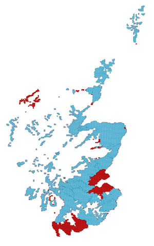
compared to the first edition mapping (in blue)
The 25 inch maps cover what were considered to be the cultivated and settled parts of Great Britain, comprising less than half of the total land area of Scotland. However, the coverage of the series from the 1890s was much greater than for the 25 inch first edition maps (1855-1882).
This was mainly because six Scottish counties had not been surveyed at the 25 inch scale before the 1890s:
- Edinburghshire
- Fife
- Haddingtonshire
- Kinross-shire
- Kirkcudbrightshire
- Wigtonshire.
These counties and the Island of Lewis had been surveyed at the six inch scale, before the decision to survey at 25 inch in 1855. In the 1890s, the 25 inch maps for these counties were constructed by replotting the earlier six-inch mapping four times larger, in spite of representations against the policy. Only the mapping of urban areas within these counties was based upon a real survey at appropriately detailed scales.
Changes in settlement and land use also led to some new 25 inch maps in the 1890s, especially covering coastal zones, and further up some rural valleys.
The principal areas without 25 inch mapping are the uncultivated, mountainous and moorland regions, particularly in the Highlands. These areas were only mapped at the six-inch scale.
 Next: Page 2 of 2
