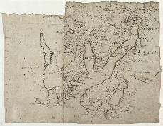
| Notes: | In the south of this map is the Firth of Clyde from Dunoon in the west to Rhu, just west of Helensburgh, in the east. The western margin is formed by Glentersan (Glen Tarsan) west of Loch Heck (Loch Eck). In the north east corner is a small part of Loch Lomund (Loch Lomond), including Cast:[le] Terbart (Tarbet, Dunbartonshire). The most northwesterly point (top left) is Arkenglas (Ardkinglas) on Loch Fyne.- The scale bar in the western (left hand) margin is probably the work of Robert Gordon.
- The hills on the western side of Loch Lung (Loch Long) and Loch Goyll (Loch Goil) are drawn in profile, as though Pont was viewing them from the opposite shore, or perhaps even from a boat on the loch.
- The word Lennox (right) refers to the possession of this land by the second Duke of Lennox, whose father had been awarded the Dukedom by King James VI of Scotland in 1581.
- Cast. Carrik (Carrick Castle) on Loch Goil is an elongated 14th-century tower of three storeys. Pont does not show its situation on a rock (Gaelic, carraig) at the water's edge, and places it too close to the mouth of the loch. It was an important staging-post for the Campbell Earls of Argyll between Inveraray and their lowland estates, and Queen Mary stayed there in 1563.
- The enclosed building shown by Pont on the north shore of Loch Aint or Haly Loch (Holy Loch, lower left) is the original collegiate church of Kilmun. Founded by Sir Duncan Campbell of Lochawe in 1442, it remained the burial-place of the Earls and Dukes of Argyll until the 20th century. Only the residential west tower survives of the building Pont saw. The loch may take its name from an earlier church associated with St Munn.
- See also Pont 14, 17 and 32, all of which overlap some of this area.
- Of the four manuscript maps by Gordon which include parts of the area, only [Gordon] 50 contains significant detail.
- The printed Blaeu map of Levinia (1654) is relevant to this area.
View the Pont Maps website. View maps by Blaeu and Robert and James Gordon. |