Town Plans / Views, 1580s-1940s
| Field | Content |
|---|---|
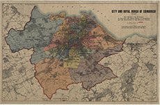
| Title: | City and royal burgh of Edinburgh, 1920. Map showing the boundary of the city and royal burgh of Edinburgh and the boundaries of the municipal wards. |
| Imprint: | Edinburgh, 1920 |
| Pagination: | 1 map ; 928 x 1469 mm. |
| Shelfmark: | Map.l.14.13 |
| Zoom Into Map: | Click on the map to view in greater detail. |