Town Plans / Views, 1580s-1940s
| Field | Content |
|---|---|
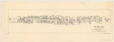
| Title: | The royal mile. |
| Imprint: | [Edinburgh : Oliver & Boyd, 1947] |
| Pagination: | 1 map ; 47 x 11 cm. |
| Shelfmark: | Map.l.84.46 |
| Zoom Into Map: | Click on the map to view in greater detail. |
| Notes: | Scale [1:3,960] "Based upon map by Mr Henry F. Kerr" Printed by J. Bartholomew & Son. Job no.: 363 (date from Bart job ledger). Shows names of closes, including some no longer in existence. |