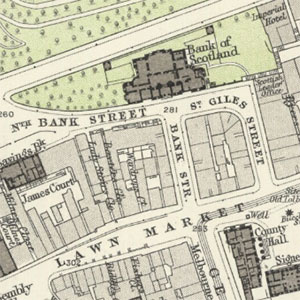
Town Plans / Views, 1580s-1940s
Detailed maps and views of cities, towns and settlements, with a focus on Scotland (but see also Ordnance Survey Town Plans of England and Wales, 1840s-1890s). The earliest surviving Scottish town plans or bird's-eye views - of Edinburgh and St Andrews - date from the 16th century. A further wave of military mapping between 1715 and 1745 is viewable on our Military Maps of Scotland pages. Many Scottish towns were not first mapped until the late 18th or early 19th centuries. The most significant surveyor of Scottish towns (published 1818-1846) was John Wood. 75 towns were mapped for the Great Reform Act (1832), whilst 7 towns were mapped by Charles Goad for Fire Insurance purposes from the 1880s. We also include Stevenson plans of harbours and related infrastructure works in towns and settlements.
See also military maps for some towns in the 18th century, Admiralty charts for harbour towns, and Ordnance Survey maps for towns after 1840.
- Further information on this group of plans
- Browse Town Plans of Scotland using a graphic index
- Browse OS Town Plans of England and Wales using a graphic index (1:500 scale)
Select the town you wish to view:
- Aberdare
- Aberdeen
- Abergavenny
- Aberystwyth
- Abingdon
- Accrington
- Airdrie
- Aldershot
- Alloa
- Alnwick
- Alva
- Andover
- Annan
- Anstruther
- Appleby
- Ashford
- Arbroath
- Ardrossan
- Ardgour (harbour)
- Arinagour (harbour)
- Ashby de la Zouch
- Ashton under Lyne
- Atherstone / Chowbent
- Atherton
- Auchmithie (harbour)
- Avoch (harbour)
- Aylesbury
- Ayr
- Bacup
- Balintore (harbour)
- Banbury
- Banff
- Bangor
- Barnard Castle
- Barnsley
- Barnstaple
- Barrow in Furness
- Basingstoke
- Bath
- Bathgate
- Batley
- Beccles
- Bedford
- Belper
- Berkhamsted
- Berwick-upon-Tweed
- Beverley
- Bideford
- Biggleswade
- Bingley
- Birkenhead
- Birmingham
- Birstal
- Bishop Auckland
- Bishop's Stortford
- Blackburn
- Blackpool
- Blairgowrie (Mill)
- Blyth
- Boddam (harbour)
- Bodmin
- Bolton
- Bo'ness
- Boston
- Bournemouth
- Bradford
- Bradford-on-Avon
- Braintree
- Brechin
- Brecon (Aberhonddu)
- Brentwood
- Bridgnorth
- Bridgwater
- Bridlington
- Bridport
- Brierley Hill
- Brighouse
- Brighton
- Bristol
- Brixham
- Bromsgrove
- Broughty Ferry
- Broxburn
- Bruichladdich (harbour)
- Broadford (harbour)
- Brodick (harbour)
- Buckhaven (harbour)
- Buckie (harbour)
- Buckingham
- Burnley
- Burslem, (The Potteries)
- Burntisland
- Burray (harbour)
- Burwick Bay (harbour)
- Burton upon Trent
- Bury
- Bury St Edmunds
- Buxton
- Caernarfon
- Camborne
- Cambridge
- Campbeltown
- Canterbury
- Cardiff
- Carmarthen
- Carnoustie
- Castleford
- Cellardyke (harbour)
- Chatham
- Chelmsford
- Cheltenham
- Chertsey
- Chester
- Chesterfield
- Chippenham
- Chorley
- Chowbent
- Christchurch
- Cirencester
- Clayton le Moors
- Cleckheaton
- Clevedon
- Coatbridge
- Cockermouth
- Colchester
- Coldingham (harbour)
- Coldstream
- Collieston (harbour)
- Colne
- Congleton
- Coulport (harbour)
- Coventry
- Cowes
- Craignure (harbour)
- Crail
- Crewe
- Crewkerne
- Crieff
- Cromarty
- Crovie (harbour)
- Croydon
- Cupar
- Cullen
- Culross
- Dalkeith
- Dalton in Furness
- Darlaston
- Dartford
- Dartmouth
- Darwen
- Dawlish
- Deal
- Denbigh
- Derby
- East Dereham
- Devizes
- Dewsbury
- Dingwall
- Dollar
- Doncaster
- Dorchester
- Dorking
- Dornoch
- Douglas, Isle of Man
- Dover
- Driffield
- Droitwich
- Dudley
- Dumbarton
- Dumfries
- Dunbar
- Dundee
- Dunfermline
- Dunglass (harbour)
- Dunkeld
- Duns
- Dunstable
- Durham
- Dysart
- East Dereham
- East Retford
- Eastbourne
- Eccles
- Edinburgh - city
- Edinburgh - environs
- Elgin
- Elie (harbour)
- Elland
- Ely
- Erskine (harbour)
- Evesham
- Exeter
- Exmouth
- Eyemouth
- Falkirk
- Falmouth
- Farnham
- Farnworth
- Farsley
- Faversham
- Findochty (harbour)
- Fisherrow (harbour)
- Fleetwood
- Folkestone
- Forfar
- Forres
- Fortrose
- Fraserburgh
- Frome
- Gainsborough
- Galashiels
- Gardenstown (harbour)
- Garston
- Gateshead
- Girvan
- Glasgow
- Glenrothes
- Glossop
- Gloucester
- Godmanchester
- Goole
- Gourock (harbour)
- Gosport
- Grangemouth (harbour)
- Grantham
- Granton (harbour)
- Gravesend
- Great Driffield
- Great Grimsby
- Great Harwood
- Great Malvern
- Great Marlow
- Great Yarmouth
- Greenlaw
- Greenock
- Grimsby
- Guildford
- Haddington
- Halifax
- Halstead
- Hamilton
- Hanley (The Potteries)
- Harrogate
- Hartlepool
- Harwich
- Haslingden
- Hastings
- Haverfordwest
- Hawick
- Hebden Bridge
- Heckmondwike
- Helensburgh
- Helmsdale (harbour)
- Hemel Hempstead
- Henley on Thames
- Hereford
- Hertford
- Heywood
- Hexham
- High Wycombe
- Hinckley
- Hindley
- Hitchin
- Holyhead (Caer Gybi)
- Holywell
- Hopeman (harbour)
- Horncastle
- Hornsey (North London)
- Horsham
- Horwich
- Hoy (harbour)
- Hucknall Torkard
- Huddersfield
- Huntingdon
- Hyde
- Idle
- Ilfracombe
- Ilkeston
- Ilkley
- Inverallochy (harbour)
- Inveraray
- Inverbervie
- Invergordon (harbour)
- Inverkeithing
- Inverness
- Inverurie
- Ipswich
- Irvine
- Isle of Ely
- Jedburgh
- Johnstone
- Keighley
- Keiss (harbour)
- Keith
- Kelso
- Kendal
- Kettering
- Kidderminster
- Kidsgrove
- Kilmarnock
- Kilrenny
- Kincardine (harbour)
- King's Lynn
- Kinghorn
- Kingston (harbour)
- Kingston upon Hull
- Kingston upon Thames
- Kinross
- Kintore
- Kirkcaldy
- Kirkcudbright
- Kirkintilloch
- Kirkwall
- Kirriemuir
- Knaresborough
- Knottingley
- Lanark
- Lancaster
- Largs
- Lauder
- Leamington Spa
- Leeds
- Leek
- Leicester
- Leigh
- Leighton Buzzard
- Leith
- Leominster
- Leslie [Glenrothes]
- Lerwick
- Leven (harbour)
- Lewes
- Lichfield
- Lincoln
- Linlithgow
- Liskeard
- Littleborough
- Liverpool
- Llandudno
- Llanelli / Llanelly
- Lochaline (harbour)
- Lochmaben
- Lochmaddy (harbour)
- London
- Long Eaton
- Longton, (The Potteries)
- Lossiemouth (harbour)
- Loughborough
- Louth
- Lowestoft
- Ludlow
- Luton
- Lybster (harbour)
- Lymington
- Lynedale, Skye (harbour)
- Lytham
- Macclesfield
- MacDuff (harbour)
- Maidenhead
- Maidstone
- Maldon
- Malton
- Manchester
- Mansfield
- March
- Margate
- Markinch [Glenrothes]
- Marlow
- Maryport
- Maybole
- Melcombe Regis (Weymouth)
- Melrose
- Melton Mowbray
- Merthyr Tydfil
- Methil (harbour)
- Middlesbrough
- Middleton
- Mirfield
- Moffat
- Mold (Wyddgrug)
- Monifieth
- Monmouth
- Montrose
- Morecambe
- Morley
- Morpeth
- Mossley
- Musselburgh
- Nairn
- Neath
- Nelson
- New Galloway
- New Malton
- Newbury
- Newcastle under Lyme (The Potteries)
- Newcastle upon Tyne
- Newhaven (harbour)
- Newmarket 1894
- Newport (Monmouthshire)
- Newport (Isle of Wight
- Newport-on-Tay
- Newtown (Montgomeryshire / Powys)
- Newton Abbot
- North Berwick
- North Shields
- Northampton
- Northwich
- Norwich
- Nottingham
- Nuneaton
- Oban
- Oldbury
- Oldham
- Ormskirk
- Oswestry
- Otley
- Oxford
- Padiham
- Paisley
- Paxton
- Peebles
- Pembroke
- Pembroke Dock
- Penrith
- Penzance
- Perth
- Peterborough
- Petersfield
- Peterhead
- Petworth
- Pittenweem
- Plumstead
- Plymouth
- Pontefract
- Pontypool
- Poole
- Port Charlotte (harbour)
- Port Ellen (harbour)
- Port Glasgow
- Port of Ness (Lewis) (harbour)
- Port Seton (harbour)
- Port Stoth, Lewis (harbour)
- Portgordon (harbour)
- Portknockie (harbour)
- Portsmouth
- Portobello
- The Potteries
- Pow of Errol (harbour)
- Prescot
- Preston
- Pudsey
- Ramsbottom
- Ramsey (Isle of Man)
- Ramsgate
- Ravensthorpe
- Rawtenstall
- Reading
- Redditch
- Redhill
- Redruth
- Retford
- Reigate
- Renfrew
- Rhyl
- Richmond (London)
- Richmond (Yorkshire)
- Ripon
- Rishton
- Rochdale
- Rochester
- Romford
- Romsey
- Rosehearty (harbour)
- Rotherham
- Rothesay
- Royal Leamington Spa
- Royton
- Rugby
- Runcorn
- Rutherglen
- Ryde
- Rye
- St. Albans
- St. Andrews
- St. Monans (harbour)
- St. Austell
- St. Helens
- St. Helier
- St. Ives
- St. Peter Port
- Saffron Walden
- Salford
- Salisbury
- Saltaire
- Saltcoats
- Sandend (harbour)
- Sandhaven (harbour)
- Sandwich
- Sanquhar
- Scalasaig (harbour)
- Scrabster (harbour)
- Scarborough
- Selby
- Selkirk
- Sevenoaks
- Sheerness
- Sheffield
- Shepton Mallet
- Sherborne
- South Shields
- Shipley
- Shrewsbury
- Skateraw (harbour)
- Skipness (harbour)
- Skipton
- Sleaford
- Slough
- South Queensferry
- Southampton
- Southport
- Sowerby Bridge
- Spalding
- Stalybridge
- Stafford
- Stamford
- Stanningley
- Stirling
- Stockton on Tees
- Stoke upon Trent (The Potteries)
- Stone
- Stonehaven
- Stornoway
- Stourbridge
- Stowmarket
- Stranraer
- Stratford on Avon
- Strathaven
- Stromness
- Stroud
- Sudbury
- Sutton in Ashfield
- Swansea
- Swindon
- Swinton
- Tain
- Tamworth
- Tankerness (harbour)
- Taunton
- Tavistock
- Tayport
- Tenby
- Tewkesbury
- Thetford
- Thurso
- Tiverton
- Todmorden
- Torquay
- Totnes
- Tring
- Troon
- Trowbridge
- Truro
- Tunbridge Wells
- Tunstall (The Potteries)
- Tyldesley
- Tynemouth
- Ullapool (harbour)
- Ulverston
- Uxbridge
- Wakefield
- Wallsend
- Walsall
- Waltham Abbey
- Ware
- Warminster
- Warrington
- Warwick
- Watford
- Wellington
- Wells
- West Bromwich
- West Cowes
- West Ferry (harbour)
- Welshpool
- Weston-super-Mare
- Weymouth
- Whitchurch
- Whitehaven
- Whitby
- Whithorn
- Wick
- Widnes
- Wigan
- Wigton
- Wigtown
- Winchester
- Windsor
- Wisbech
- Wishaw
- Withington
- Wokingham
- Wolverhampton
- Woodbridge
- Woolwich
- Worcester
- Workington
- Worksop
- Wormit
- Worthing
- Wrexham
- Yeovil
- York
Select the Scottish town you wish to view:
- Aberdeen
- Airdrie
- Alloa
- Alva
- Annan
- Anstruther
- Arbroath
- Ardrossan
- Ardgour (harbour)
- Arinagour (harbour)
- Auchmithie (harbour)
- Avoch (harbour)
- Ayr
- Balintore (harbour)
- Banff
- Bathgate
- Blairgowrie (Mill)
- Boddam (harbour)
- Bo'ness
- Brechin
- Broughty Ferry
- Broxburn
- Bruichladdich (harbour)
- Broadford (harbour)
- Brodick (harbour)
- Buckhaven (harbour)
- Buckie (harbour)
- Burntisland
- Burray (harbour)
- Burwick Bay (harbour)
- Campbeltown
- Carnoustie
- Cellardyke (harbour)
- Coatbridge
- Coldingham (harbour)
- Coldstream
- Collieston (harbour)
- Coulport (harbour)
- Craignure (harbour)
- Crail
- Crieff
- Cromarty
- Crovie (harbour)
- Cupar
- Cullen
- Culross
- Dalkeith
- Dingwall
- Dollar
- Dornoch
- Dumbarton
- Dumfries
- Dunbar
- Dundee
- Dunfermline
- Dunglass (harbour)
- Dunkeld
- Duns
- Dysart
- Edinburgh - city
- Edinburgh - environs
- Elgin
- Elie (harbour)
- Erskine (harbour)
- Eyemouth
- Falkirk
- Findochty (harbour)
- Fisherrow (harbour)
- Forfar
- Forres
- Fortrose
- Fraserburgh
- Frome
- Galashiels
- Gardenstown (harbour)
- Girvan
- Glasgow
- Glenrothes
- Gloucester
- Gourock (harbour)
- Grangemouth (harbour)
- Granton (harbour)
- Greenlaw
- Greenock
- Haddington
- Hamilton
- Hawick
- Helensburgh
- Helmsdale (harbour)
- Hopeman (harbour)
- Hoy (harbour)
- Inverallochy (harbour)
- Inveraray
- Inverbervie
- Invergordon (harbour)
- Inverkeithing
- Inverness
- Inverurie
- Irvine
- Jedburgh
- Johnstone
- Keiss (harbour)
- Keith
- Kelso
- Kilmarnock
- Kilrenny
- Kincardine (harbour)
- Kinghorn
- Kingston (harbour)
- Kinross
- Kintore
- Kirkcaldy
- Kirkcudbright
- Kirkintilloch
- Kirkwall
- Kirriemuir
- Lanark
- Largs
- Lauder
- Leith
- Leslie [Glenrothes]
- Lerwick
- Leven (harbour)
- Linlithgow
- Lochaline (harbour)
- Lochmaben
- Lochmaddy (harbour)
- London
- Lossiemouth (harbour)
- Lybster (harbour)
- Lynedale, Skye (harbour)
- MacDuff (harbour)
- Markinch [Glenrothes]
- Maybole
- Melrose
- Methil (harbour)
- Moffat
- Monifieth
- Montrose
- Musselburgh
- Nairn
- New Galloway
- Newhaven (harbour)
- Newport-on-Tay
- Newton Abbot
- North Berwick
- Oban
- Paisley
- Paxton
- Peebles
- Perth
- Peterhead
- Pittenweem
- Port Charlotte (harbour)
- Port Ellen (harbour)
- Port Glasgow
- Port of Ness (Lewis) (harbour)
- Port Seton (harbour)
- Port Stoth, Lewis (harbour)
- Portgordon (harbour)
- Portknockie (harbour)
- Portobello
- Pow of Errol (harbour)
- Renfrew
- Rosehearty (harbour)
- Rothesay
- Rutherglen
- St. Andrews
- St. Monans (harbour)
- Salisbury
- Saltcoats
- Sandend (harbour)
- Sandhaven (harbour)
- Sanquhar
- Scalasaig (harbour)
- Scrabster (harbour)
- Selkirk
- Skateraw (harbour)
- Skipness (harbour)
- South Queensferry
- Stirling
- Stonehaven
- Stornoway
- Stranraer
- Strathaven
- Stromness
- Tain
- Tankerness (harbour)
- Tayport
- Thurso
- Tobermory
- Torquay
- Troon
- Trowbridge
- Ullapool (harbour)
- West Ferry (harbour)
- Weston-super-Mare
- Whithorn
- Wick
- Wigtown
- Wishaw
- Wormit
Select the English / Welsh town you wish to view:
- Aberdare
- Abergavenny
- Aberystwyth
- Abingdon
- Accrington
- Alnwick
- Altrincham
- Aldershot
- Andover
- Appleby
- Ashford
- Ashby de la Zouch
- Ashton under Lyne
- Atherstone / Chowbent
- Atherton
- Aylesbury
- Bacup
- Banbury
- Bangor
- Barnard Castle
- Barnsley
- Barnstaple
- Barrow in Furness
- Basingstoke
- Bath
- Batley
- Beccles
- Bedford
- Belper
- Berkhamsted
- Beverley
- Bideford
- Biggleswade
- Bingley
- Birkenhead
- Birmingham
- Birstal
- Bishop Auckland
- Bishop's Stortford
- Blackburn
- Blackpool
- Blyth
- Bodmin
- Bolton
- Boston
- Bournemouth
- Bradford
- Bradford-on-Avon
- Braintree
- Brecon (Aberhonddu)
- Brentwood
- Bridgnorth
- Bridgwater
- Bridlington
- Bridport
- Brierley Hill
- Brighouse
- Brighton
- Bristol
- Brixham
- Bromsgrove
- Buckingham
- Burnley
- Burslem, (The Potteries)
- Burton upon Trent
- Bury
- Bury St Edmunds
- Buxton
- Caernarfon
- Camborne
- Cambridge
- Canterbury
- Cardiff
- Carmarthen
- Castleford
- Chatham
- Chelmsford
- Cheltenham
- Chertsey
- Chester
- Chesterfield
- Chesterton
- Chichester
- Chippenham
- Chorley
- Chowbent
- Christchurch
- Cirencester
- Clayton le Moors
- Cleckheaton
- Clevedon
- Cockermouth
- Colchester
- Colne
- Congleton
- Coventry
- Cowes
- Crediton
- Crewe
- Crewkerne
- Croydon
- Dalton in Furness
- Darlaston
- Dartford
- Dartmouth
- Darwen
- Dawlish
- Deal
- Denbigh
- Derby
- East Dereham
- Devizes
- Dewsbury
- Doncaster
- Dorchester
- Dorking
- Douglas, Isle of Man
- Dover
- Driffield
- Droitwich
- Dudley
- Dunstable
- Durham
- East Dereham
- East Retford
- Eastbourne
- Eccles
- Elland
- Ely
- Evesham
- Exeter
- Exmouth
- Falmouth
- Farnham
- Farnworth
- Farsley
- Faversham
- Fleetwood
- Folkestone
- Frome
- Gainsborough
- Garston
- Gateshead
- Glossop
- Gloucester
- Godmanchester
- Goole
- Gosport
- Grantham
- Gravesend
- Great Driffield
- Great Grimsby
- Great Harwood
- Great Malvern
- Great Marlow
- Great Yarmouth
- Grimsby
- Guildford
- Halifax
- Halstead
- Hanley (The Potteries)
- Harrogate
- Hartlepool
- Harwich
- Haslingden
- Hastings
- Haverfordwest
- Hebden Bridge
- Heckmondwike
- Hemel Hempstead
- Henley on Thames
- Hereford
- Hertford
- Hexham
- Heywood
- High Wycombe
- Hinckley
- Hindley
- Hitchin
- Holyhead (Caer Gybi)
- Holywell
- Horncastle
- Hornsey (North London)
- Horsham
- Horwich
- Hucknall Torkard
- Huddersfield
- Huntingdon
- Hyde
- Idle
- Ilfracombe
- Ilkeston
- Ilkley
- Ipswich
- Isle of Ely
- Keighley
- Kendal
- Kettering
- Kidderminster
- Kidsgrove
- King's Lynn
- Kingston upon Hull
- Kingston upon Thames
- Knaresborough
- Knottingley
- Lancaster
- Leamington Spa
- Leeds
- Leek
- Leicester
- Leigh
- Leighton Buzzard
- Leominster
- Lewes
- Lichfield
- Lincoln
- Liskeard
- Littleborough
- Liverpool
- Llandudno
- Llanelli / Llanelly
- London
- Long Eaton
- Longton, (The Potteries)
- Loughborough
- Louth
- Lowestoft
- Ludlow
- Luton
- Lymington
- Lytham
- Macclesfield
- Maidenhead
- Maidstone
- Maldon
- Malton
- Manchester
- Mansfield
- March
- Margate
- Marlow
- Maryport
- Melcombe Regis (Weymouth)
- Melton Mowbray
- Merthyr Tydfil
- Middlesbrough
- Middleton
- Mirfield
- Mold (Wyddgrug)
- Monmouth
- Morecambe
- Morley
- Morpeth
- Mossley
- Neath
- Nelson
- New Malton
- Newark
- Newbury
- Newcastle under Lyme (The Potteries)
- Newcastle upon Tyne
- Newmarket 1894
- Newport (Monmouthshire)
- Newport (Isle of Wight
- Newtown (Montgomeryshire / Powys)
- Newton Abbot
- North Shields
- Northampton
- Northwich
- Norwich
- Nottingham
- Nuneaton
- Oldbury
- Oldham
- Ormskirk
- Oswestry
- Otley
- Oxford
- Padiham
- Pembroke
- Pembroke Dock
- Penrith
- Penzance
- Peterborough
- Petersfield
- Petworth
- Plumstead
- Plymouth
- Pontefract
- Pontypool
- Poole
- Portsmouth
- The Potteries
- Prescot
- Preston
- Pudsey
- Ramsbottom
- Ramsey (Isle of Man)
- Ramsgate
- Ravensthorpe
- Rawtenstall
- Reading
- Redditch
- Redhill
- Redruth
- Retford
- Reigate
- Rhyl
- Richmond (London)
- Richmond (Yorkshire)
- Ripon
- Rishton
- Rochdale
- Rochester
- Romford
- Romsey
- Rotherham
- Royal Leamington Spa
- Royton
- Rugby
- Runcorn
- Ryde
- Rye
- St Albans
- St Austell
- St Helens
- St. Ives
- Saffron Walden
- Salford
- Salisbury
- Sandwich
- Scarborough
- Selby
- Sevenoaks
- Sheerness
- Sheffield
- Shepton Mallet
- Sherborne
- Shipley & Saltaire
- Shrewsbury
- Skipton
- Sleaford
- Slough
- Southampton
- Southport
- South Shields
- Sowerby Bridge
- Spalding
- Stafford
- Stalybridge
- Stamford
- Stanningley
- Stockton on Tees
- Stoke upon Trent (The Potteries)
- Stone
- Stourbridge
- Stowmarket
- Stratford on Avon
- Stroud
- Sudbury
- Sutton in Ashfield
- Swansea
- Swindon
- Swinton
- Tamworth
- Taunton
- Tavistock
- Tenby
- Tewkesbury
- Thetford
- Tiverton
- Todmorden
- Tonbridge
- Torquay
- Totnes
- Tring
- Trowbridge
- Truro
- Tynemouth
- Tunbridge Wells
- Tunstall (The Potteries)
- Tyldesley
- Ulverston
- Uxbridge
- Wakefield
- Wallsend
- Walsall
- Waltham Abbey
- Ware
- Warminster
- Warrington
- Warwick
- Watford
- Wednesbury
- Wellingborough
- Wellington
- Wells
- Welshpool
- West Bromwich
- West Cowes
- Weston-super-Mare
- Weymouth
- Whitby
- Whitchurch
- Whitehaven 1862-63
- Widnes
- Windsor
- Wigan
- Wigton
- Winchester
- Wisbech
- Withington
- Wokingham
- Wolverhampton
- Woodbridge
- Woolwich
- Worcester
- Workington
- Worksop
- Worthing
- Wrexham
- Yeovil
- York