Estate Maps, 1750s-1900s

| Name: | Boulton, John, 1830-1874 |
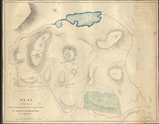
| Title: | Plan of the Hills Proposed to be Planted on the Kilmorack Estate |
| Imprint: | 1851 |
| Pagination: | 1 map: col.; 66 x 83 cm. |
| Shelfmark: | Lovat231 |
| Notes: | A not very detailed map of the hilll country between Ruisaurie + Ruilick and Loch Bonni (Loch nan Bonnach) Shows the dyke to be built to encompass all this plantation. Scale 1:4310. (15 chains = 7 cm ). Courtesy of Lovat Highland Estates and the North of Scotland Archaeological Society. View Lovat Highland Estates mapping |
| Zoom Into Map: | Click on the map to view in greater detail. |