Estate Maps, 1750s-1900s

| Name: | Gordon, David, 1820-1893 |
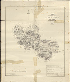
| Title: | Plan of that part of Stratherrick which forms the Shooting Range of Corriegarth, 1878. |
| Imprint: | 1878 |
| Pagination: | 1 map; 60 x 50 cm. |
| Shelfmark: | Lovat160 |
| Notes: | A red boundary delimits an area of ground around Strath Garth, with a table of land measures. A very similar but not identical map to Lovat192. Scale 1:31680. (1 mile = 2" ). Courtesy of Lovat Highland Estates and the North of Scotland Archaeological Society. View Lovat Highland Estates mapping |
| Zoom Into Map: | Click on the map to view in greater detail. |