Estate Maps, 1750s-1900s

| Name: | Gordon, David, 1820-1893 |
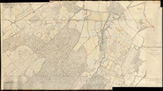
| Title: | Plan of Part of the Lovat Property in the Parish of Kiltarlity which extends from Tomnacross to Femnock & Crerag inclusively |
| Imprint: | 1874 |
| Pagination: | 1 map: col.; 102 x 187 cm. |
| Shelfmark: | Lovat048 |
| Notes: | A map formed from parts of 1st edition 6" OS maps, then over-drawn and -coloured. Scale 1:2514. (10 chains = 8 cm ). Courtesy of Lovat Highland Estates and the North of Scotland Archaeological Society. View Lovat Highland Estates mapping |
| Zoom Into Map: | Click on the map to view in greater detail. |