
GREMLIN - Land Use Information
Introduction

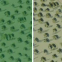
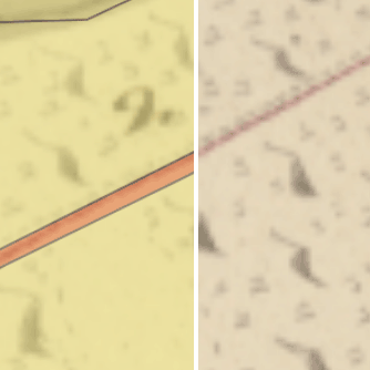
These map viewers allow maps and land use to be compared over the last 200 years for the Earlstoun and Holm Estates in the parishes of Balmaclellan, Dalry, and Kells in the Glenkens, Galloway. View Help on the map viewers.
GREMLIN is the Glenkens Rectified Estate Mapping and Land use Information Network.
The following sections explain how land use has been described or categorised over time on the different map layers, beginning with the estate map layer (1799-1817). By quantifying these categories, we show summary figures and charts for land use changes over time.
- Estate map layer (1799-1817)
- Understanding the Estate map land use categories (1799-1817)
- Land Utilisation Survey (1930s)
- Historic Landscape Assessment (HLA) map (2015)
- Land Cover Map (2021)
- Areas
- Land use changes over time
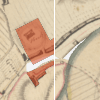
Estate map layer (1799-1817)

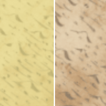
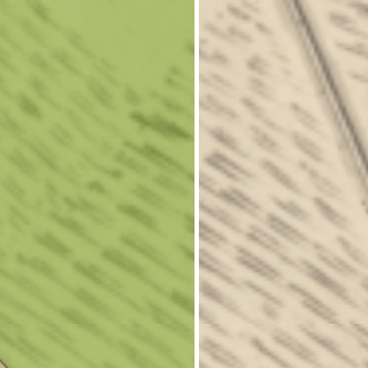
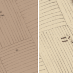
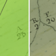
We tried to record the land use on the 1799-1817 estate map layer using the same terminology as the original estate surveyors. This divided the landscape into five main cateogires ( pasture, moss, arable, meadow, and wood), with six other categories ( road, houses, gardens, etc., enclosed pasture, bog, moor, and loch). Sometimes, descriptive terms were used in addition to the primary land use, and minor variations in terminology were standardised:
- the small sections of "holme", "riverbank", and "holme and meadow" were grouped in the "meadow" category.
- the glebes were re-allocated under "arable" or "pasture", depending upon symbolisation
- the 69 acres of "enclosed pasture" was grouped with "pasture"
- the "Horse Park" at Fingland was grouped with "pasture"
We have chosen to colour-code these along similar lines to the 1930s Land Utilisation Survey and 2015 Historic Landscape Assessment map in our viewer, to enable easier comparison over time. This uses:
- brown for arable land including rotation grass
- light green for meadow and permanent grass
- yellow for heathland / moorland or rough hill pasture
- dark green for forests and woodland
- red for agriculturally unproductive land or man-made structures
Understanding the Estate map land use categories (1799-1817)
For further reading on the agriculture of the time as well as general background:
- General View of the Agriculture of Galloway etc. by the Rev, Samuel Smith, Minister of Borgue. Published in 1810.
- The Statistical Accounts for Kells, Dalry and Balmaclellan (1790s-1840s) are also useful. Both Old and New versions.
Pasture and Moor
On these maps "Pasture" normally refers to all rough grazing mainly on the hill of the relevant farms. However, "pasture" can also refer to grass when cropped as hay and as available for pasturing within a cropping rotation (see "Arable" below).
Rev. Smith probably puts it best. "The waste lands in Galloway, consisting of bogs, moors, and mountains, comprehend a very large proportion of the district. At a moderate computation they may reckoned at one-third of it. But to state accurately, even though we had access to the surveys of every individual farm, would be impossible; for the transition from absolute barrenness to what would be esteemed good pasture lands, proceeds through so many intermediate stages, and by such insensible gradations, that to fix the limits would be arbitrary, and give rise to great diversity of opinions." (See 1) above)
The livestock on the hills will have mainly been sheep and cattle. It was customary to put the livestock out onto the hill for the summer and bring them closer in for the winter where they could be more easily fed. It is noticeable that the farms in the North of the GREMLIN range show farm buildings as already ruined. This probably implies the increase of larger sheep units as opposed to a more mixed farm. Brian Bonnyman in The Third Duke of Buccleuch and Adam Smith explains this trend taking place in the Langholm area in the 1750s.
There are 69 acres of ground which were described as Enclosed Pasture, and these have been grouped under 'Pasture and Moor' too.
Interestingly there is surprisingly little enclosed work that has been done even lower down the hill. It appears that most of the dyking that has been done is on the perimeter dykes rather than anything else. However, there are a number of interesting enclosures of pasture that have been made out on the hill and often in blocks further away from the farm.
Rev. Smith sees most of the dyking as separation of winter and summer pasture. The latter is of course further up the hill. He continues "In every moor farm, it is considered to be an essential requisite to have a good tup park, which serves, also, for various purposes, at the different seasons of the year, when it is not necessary to separate the rams from the ewes". This is most likely the reason for most of these enclosures.
Moss and Bog
The use of the words "moss" and "bog" appear to fairly arbitrary with both sometimes appearing on the same map and showing similar features. Rev. Smith uses the title "Bogs, provincially Moses or Flowes". The nomenclature appears to be interchangeable at this time. With our more standardised manner of speech, we would see the majority of these as “Peat Bogs”. However, there will be some that are more a kind of acidic alluvial soup rather than being pure peat.
Rev. Smith, again, "the extent of these almost exceeds credibility, being probably not less than one-tenth or one-twelfth of the district. In some places they stretch out with very little interruption, to the length and breadth of several miles. Their depth is often also very great, being from 10-20 feet, and in some cases, probably, still more." He goes on, "Such vast tracts of moss, in its natural state absolutely good for nothing, afford the most ample scope for exercising the talents and the ingenuity of spirited improvers"
It should be remembered that these bogs, far from being useless, were often the primary source of fuel for many a farmstead. Rev. Smith, of course, complains "...they dig peat-pots everywhere indiscriminately; commonly, however, near the outsides of the moss, as if on purpose to render it good for nothing as soon as possible; or to prepare pits for drowning their cattle, a circumstance which not infrequently happens."
Although much of the mapping is obviously accurately detailed, some of the smooth lines of the Moss delineation appears to be a bit too good to be true. It does appear to have been done perhaps by eye from on top of an appropriate hill. The result does look as though some of the nuance has been lost.
Arable
Arable cropping was being improved by leaps and bounds by 1800. Many farmers were operating strict rotations and the days of continual oat crops were mostly at an end but various. Rev. Smith writes. "The barbarous practice of taking three crops of oats on land broken up from grass still prevails in many parts of the country. The lands are then laid out to pasture in this impoverished state but more frequently this is followed with a green crop (turnips, kale, etc.) or fallow; and they are afterwards sown with barely, or early oats, and a crop of hay is taken before they are left in pasture." He continues "Such of the proprietors, however, as pay attention to the improvement of their estates, always restrict the tenants to two white crops before fallow or a green crop; and many of the more intelligent farmers, without any restrictions from the landlord, now adopt this plan."
Smith notes that everyone is involved in the rearing of livestock and so mixing pasture with crops is definitely expedient. The result is that on arable land one had "no more than one-fourth or one-third of the arable land in crops of any kind". Cropping was also a way of retaining the self-sufficiency of the farms especially in more remote areas. The crops would have included oats, barely, potatoes, turnips etc.
Meadow
Meadows were highly specific areas and were not just simply fields with grass in them. They were normally on the flat next to a burn or a river and almost always spent most of the year in a damp condition. In addition, the area may well have become flooded at various times of the year and thus gain nutrients from that flooding. Thus, we find the meadows in the damper areas between the knowes and small hills and stretching in a thin line along the river and burn banks.
In an ideal world meadow would be cut on a yearly basis. This would not always happen. Sufficient hay may have been got from the arable section of the farm or the meadow area may have been too large for the farm to work with etc. Normally the cutting would have been done in late July or perhaps early August.
However, it is this area that would have been the most flower and insect rich. The periodic cutting would have encouraged the flowers. Birds such as the corncrake would have delighted in these areas.
Wood
Although some of the woods on these maps will have been of "natural" origins, there is plenty evidence to show that much of what is shown on the maps has been consistently managed for a considerable length of time. The main bulk will have been producing tan bark and charcoal on a 20–30-year coppice rotation mainly for export to Cumbria. Although, perhaps, oak is probably the main species Scots pine was also planted in significant amounts.
The small hilltop clumps on the more southerly area will have also contained things like beech and larch. Those clumps being mainly for the shelter of livestock as well as providing cover for various sorts of game. Larger trees will not have been readily available except from around the larger houses.
Roads
The roads shown are the main ones that are either going from farm to farm or the main roads that are going from village to village. There are some that have not been vectorised simply because this would detract from other areas of land use and perhaps start to distort the figures.
Houses, Gardens etc.
This category is pretty well self-explanatory. The various other things that may be included in this section would be stack yards and orchards as well as other sundry barns and stock buildings.
Go to GREMLIN Overlay viewer.
Land Utilisation Survey (1930s)
The 1930s Land Utilisation Survey (1930s) was the first systematic and comprehensive depiction of land cover and use in Scotland (1931-1935), under the superintendence of L. Dudley Stamp. The recording of land use was carried out by volunteers, particularly schoolchildren and students, using Ordnance Survey six-inch to the mile field sheets. All land was colour-coded into six main categories (listed above in the estate map layer) and reduced to the one-inch to the mile scale for publication.
Historic Landscape Assessment (HLA) map (2015 )

The 2015 HLA map from Historic Environment Scotland is a Scotland-wide view of land use in modern and past times. As well as enabling us to visualise recent land use the HLA map also reveals the extent of surviving prehistoric, historic and modern land uses. Its broad classification of land use types has allowed HLA types to be matched easily to those mapped on the 1930s Land Utilisation Survey map. HLA uses 54 current land use types and these have been matched with the six broad classes shown in the 1930s Land Utilisation Survey map to produce the HLA map shown in this viewer. We display the HLA layer here on a background of modern Ordnance Survey Opendata, including Miniscale, 1:250,000 colour raster, and OS Streetview.
Land Cover Map (2021)

The Land Cover map, from the UK Centre for Ecology and Hydrology, describes the physical material on the land surface, categorising it into land cover classes from grassland, woodland and fresh water to urban and suburban built-up areas. UKCEH has a long history of using satellite imagery to map land cover from the first national Land Cover Map of Great Britain in 1990. Training data were automatically selected from stable land covers over the interval of 2017 to 2019. A Random Forest classifier used these to classify four composite images representing per season median surface reflectance. Seasonal images were integrated with context layers (e.g., height, aspect, slope, coastal proximity, urban proximity and so forth) to reduce confusion among classes with similar spectra.
We do not have the ability to change colour for the Land Cover Map. There are some similarities in its colour scheme to the Estate map layer, Land Utilisation Survey, and HLA map, but there are some important differences too. This is particularly in using red for broadleaved woodland, and yellow for fen and marsh, but also some of the different types of arable and grassland.
Go to GREMLIN Overlay viewer.
Areas
The original estate maps usually recorded areal extents in Scots acres (6104 square yards), which were larger than Imperial or English acres (1.26118345 times larger). On these estate maps, acres are usually divided into 4 roods (1,526 square yards), which are divided into 40 square falls (the fall being 38 square yards). However, on some of the newly surveyed plans by James Anderson, decimals are shown instead of roods and falls (an early example of decimalisation in estate mapping). Over the course of the 19th century, Scots acres increasingly fell out of use and were replaced by Imperial or English acres on Scottish estate maps.
In this viewer, we show areal extents in modern acres and hectares.
Go to GREMLIN overlay viewer.
Land use changes over time
Land use is described in slightly different ways between the estate maps (1799-1817) and the Historic Landscape Assessment layer (2015), but the main categories and their extents are summarised below:
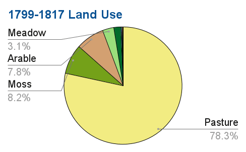
| Land Use | Acreage | Percentage |
|---|---|---|
| Pasture | 28,403 | 78% |
| Moss | 2,977 | 8% |
| Arable | 2,811 | 8% |
| Meadow | 1,133 | 3% |
| Wood | 676 | 2% |
| Road | 96 | 0.2% |
| Houses, Gardens, etc. | 40 | 0.1% |
| Moor | 27 | <0.1% |
| Bogs | 6.04 | <0.1% |
| Loch | 0.91 | <0.1% |
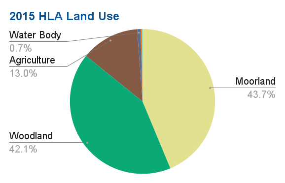
| Land Use | Acreage | Percentage |
|---|---|---|
| Moorland and Rough Grazing | 15,813 | 43% |
| Woodland and Forestry | 15,213 | 42% |
| Agriculture and Settlement | 4,701 | 13% |
| Water Body | 265 | 0.7% |
| Designed Landscape | 103 | 0.3% |
| Energy, Extraction and Waste | 44 | 0.1% |
| Rural Settlement | 7.1 | <0.1% |
| Built-up Area | 6.4 | <0.1% |
Project
This is a collaborative project between the Dumfries Archival Mapping Project, the Galloway Glens Landscape Partnership, and the National Library of Scotland. View Project GREMLIN press release.
We would welcome information on any mistakes, or suggestions for improvements. Please contact us at maps@nls.uk.
Go to Gremlin Overlay viewer, or read Help on the map viewers.