Military Maps of Scotland (18th century)
| Field | Content |
|---|---|
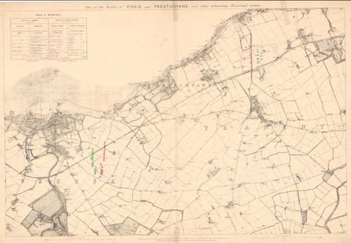
| Title: | Sites of the battles of Pinkie and Prestonpans, and other interesting historical events |
| Description: | 1 map ; 673 x 1014 mm. |
| Original Survey: | 1855 |
| Date on Map: | 1855 |
| Placename: | Prestonpans |
| Parish: | Gladsmuir |
| County: | Haddingtonshire/East Lothian |
| Shelfmark: | EMS.s.732 |
| Zoom Into Map: | Click on the map to view in greater detail. |
All images © National Library of Scotland