Military Maps of Scotland (18th century)
| Field | Content |
|---|---|
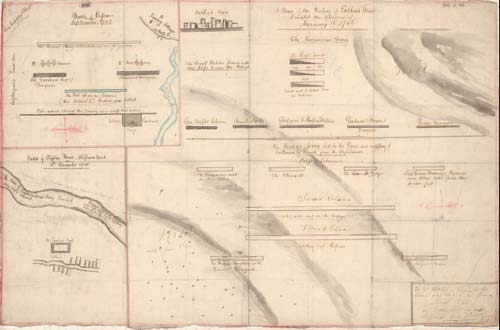
| Title: | Battle of Preston: - September 1745. (A plan of the victory of Falkirk Muir fought the afternoon of January 16 [sic, ie. 17th] 1746. - Battle of Clifton Muir, Westmorland. 18th December 1745). |
| Description: | 3 manuscript maps on 1 sheet ; 417 x 628 mm. |
| Original Survey: | ca. 1746 |
| Date on Map: | ca. 1746 |
| Placename: | Falkirk ; Prestonpans |
| Parish: | Falkirk ; Gladsmuir |
| County: | Stirlingshire, Inverness-shire |
| Shelfmark: | EMS.s.164 |
| Zoom Into Map: | Click on the map to view in greater detail. |
All images © National Library of Scotland