Military Maps of Scotland (18th century)
| Field | Content |
|---|---|
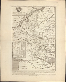
| Title: | An exact plan of His Majesty's great roads through the Highlands of Scotland / (Ad: Rutherfurd delin. C. Mosley sculp.). |
| Name: | Rutherfurd, Andrew. |
| Description: | 1 map ; 521 x 351 mm |
| Original Survey: | 1745 |
| Date on Map: | 1745 |
| Placename: | GreatRoads |
| County: | Inverness-shire/Perthshire |
| Shelfmark: | EMS.s.90b |
| Zoom Into Map: | Click on the map to view in greater detail. |
All images © National Library of Scotland