Military Maps of Scotland (18th century)
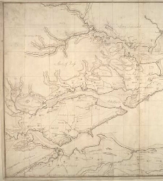
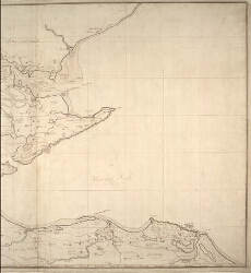
| Name: | [Wade, George] |
| Title: | [Plan of the Murray Firth and Cromarty Firth, with parts of the Shires of Inverness, Sutherland, Ross, Nairn, and Elgin. Showing roads |
| Date on Map: | 1730 |
| Description: | 1 manuscript map ; 575 x 906 mm., on sheet, 600 x 934 mm |
| County: | Inverness, Sutherland, Ross & Cromartyshire |
| Shelfmark: | Acc.10497 Wade.58d |
| Zoom Into Map: | Click on the maps below to order image or view in greater detail. |
All images © National Library of Scotland
Copyright Enquiries & Copies Help